CTD profiles and Triaxus sections set the scene for SOLACE sites
Stephanie Zeliadt & Steve Thomas
MNF
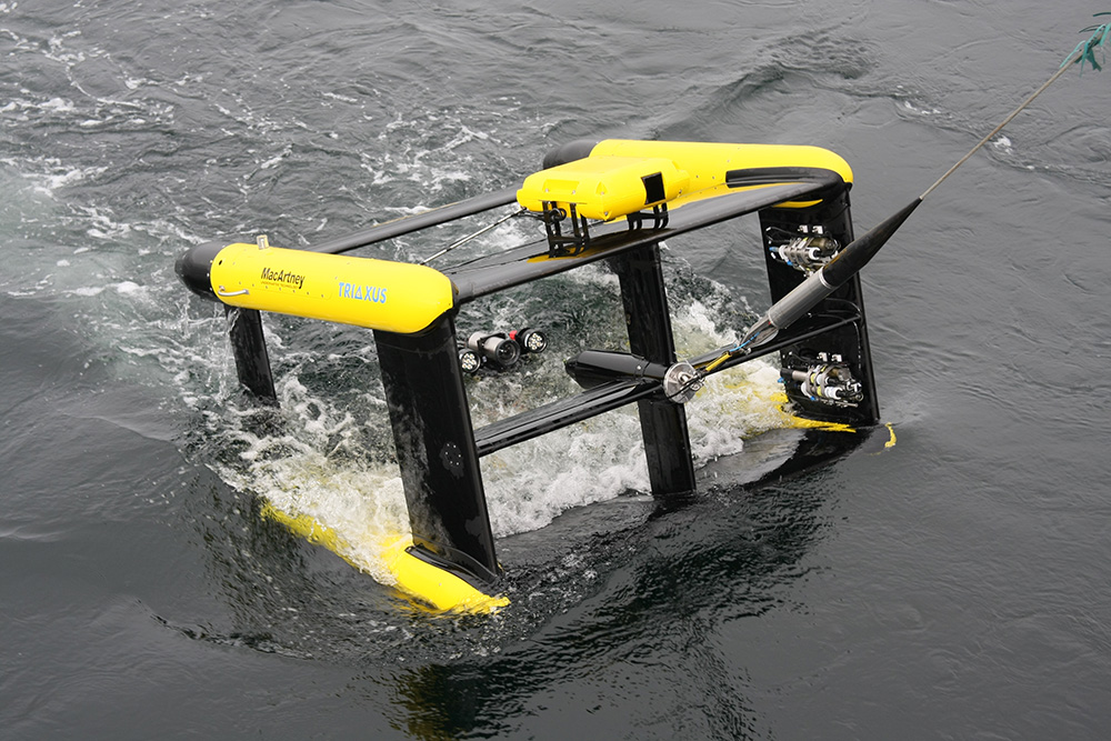
The gaping ‘mouth’ of the Triaxus as it surfaces for recovery onto the RV Investigator. Instruments such as the LOPC (Laser Optical Plankton Counter, yellow body on the front, top) are located all over the rectangular carbon fibre frame.
At any given time during the SOLACE voyage on the RV Investigator, the MNF support teams are dashing around preparing instruments for deployment and analysing and processing the data collected. Two of the main workhorse instruments are the CTD and the Triaxus. The information obtained by these two instruments helps the SOLACE team make important calls on the suitability of a site for a longer term multi-week occupation.
CTD
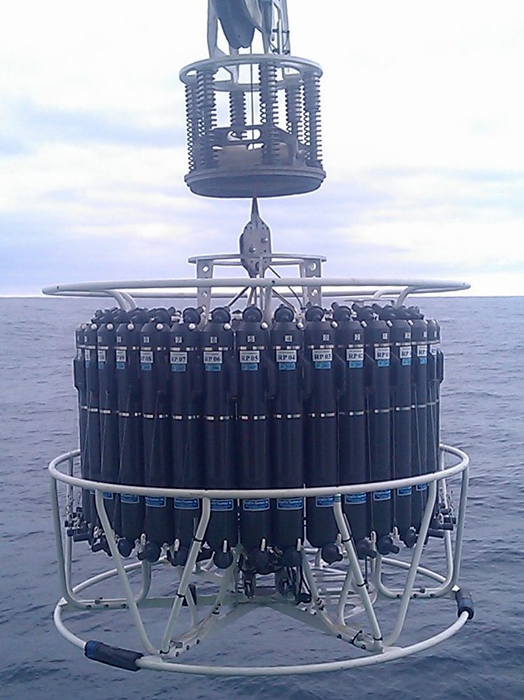
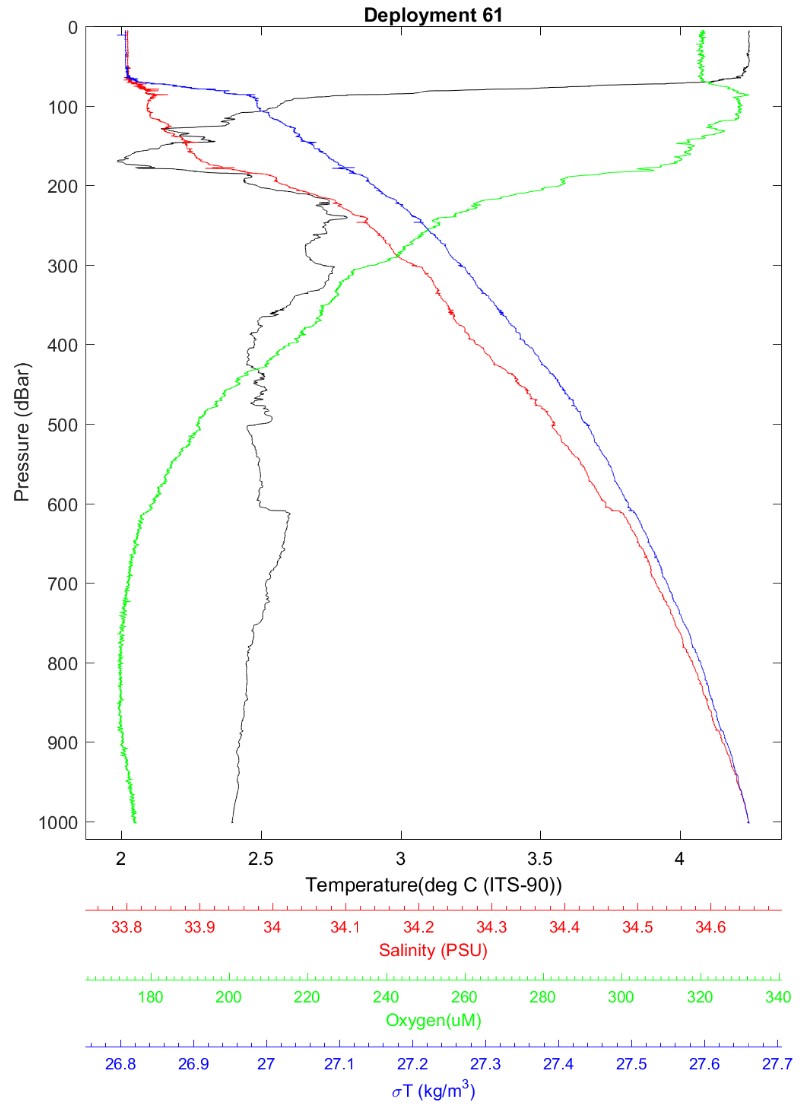
The CTD is the primary water column and sampling tool on SOLACE.
It stands for Conductivity-Temperature-Depth and, as its name suggests, provides us with highly accurate measurements of ocean temperature and electrical conductivity (which indicates salinity) at any depth.
It has the capability of taking additional instruments and we use it to also take measurements of dissolved oxygen, radiation (in the range for photosynthesis), chlorophyll, transmissivity and ocean current velocity.
In addition, it carries 36 water sample bottles (called Niskins) each holding 12 litres.
From the Operations Room onboard RV Investigator, SOLACE scientists can watch the sensor measurements coming through as the CTD descends and then take water samples at key depths as the CTD returns to the surface. The suite of instantaneously recording sensors are either on the central base of the frame (just under the bottles) or within the ‘circle’ of bottles.
On this voyage, the CTD is also carrying specialised Underwater Video Profilers (UVP5, and the prototype UVP6) that are being used to cross-compare their profiles of multiple particle classes with those of a UVP6 instrument on the profiling floats we deployed in subantarctic and polar waters.
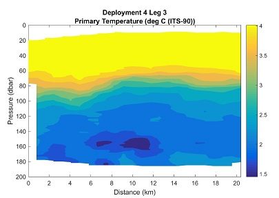
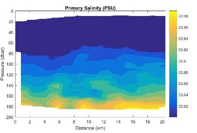
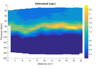
Data plots obtained using CTD
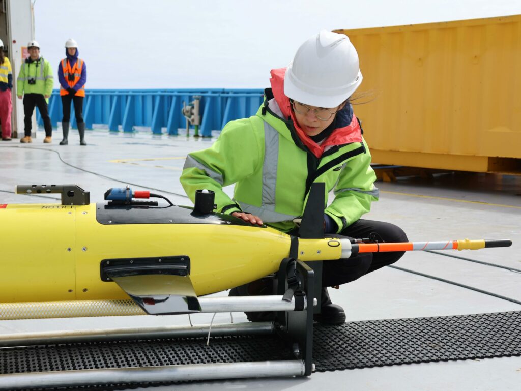
Triaxus
While the CTD can quickly measure the vertical profile of the water column, the Triaxus is a towed sampling platform and provides a more comprehensive horizontal section through a slice of the ocean by undulating through the upper 200m of water as it is towed behind the vessel at around 8 kts. The data are processed with a series of interpolations which fill in the spaces between data points to provide a continuous map of the properties of the water mass the vehicle has traversed.
This allows us to determine the horizonal extent of features such as blooms or deep chlorophyll features over a large area very quickly which then provides enough information to select sample sites. The ship time can then be used very efficiently by heading straight back to these sites to conduct detailed sampling with main CTD, nets, optics and trace metal measurements.
Data plots obtained using Triaxus