Moorings: Sentinels to monitor ocean heat when we’re not there
11 April 2025 — by Dr Laura Herraiz Borreguero (physical oceanographer: CSIRO Environment, AAPP)
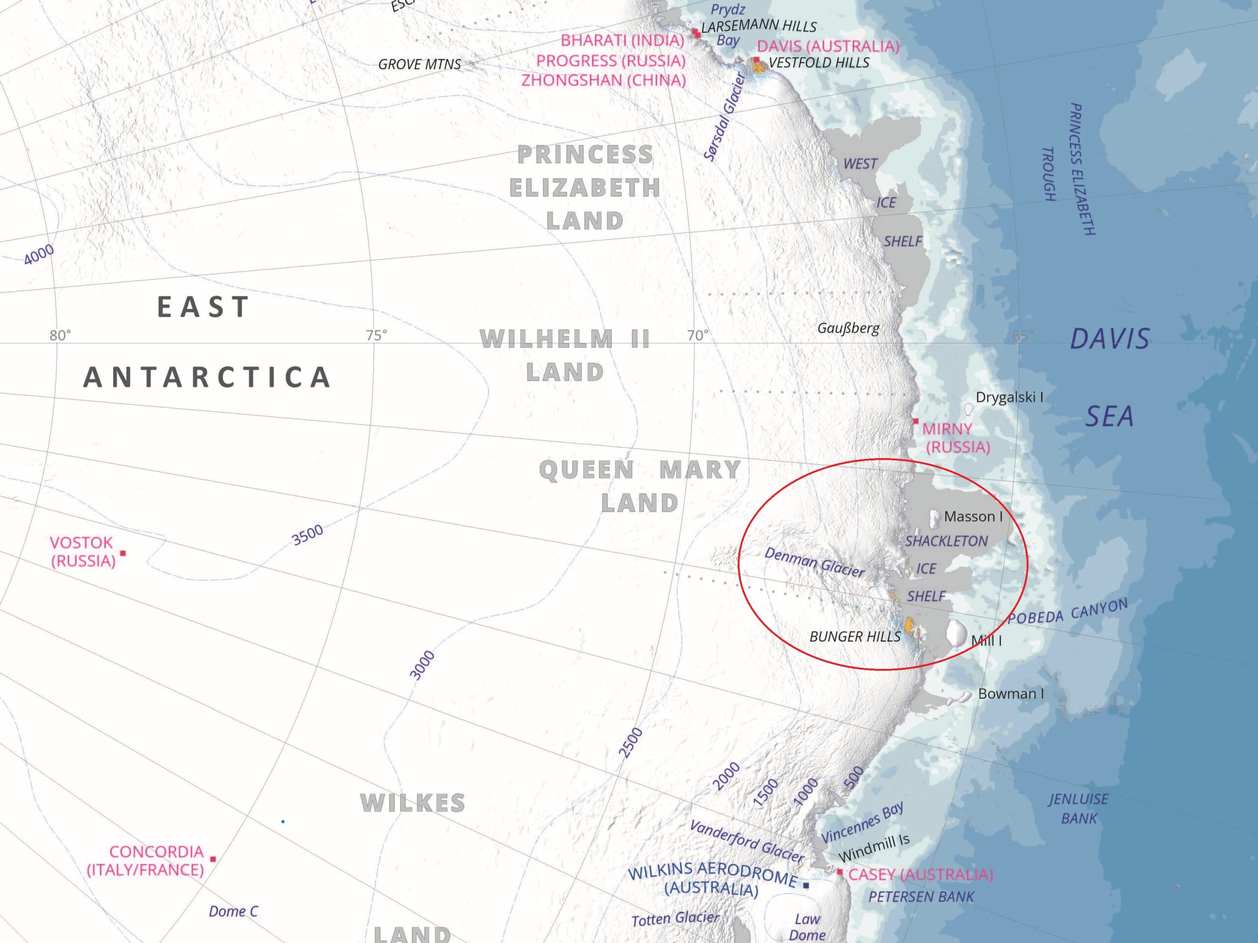
From icebreaker RSV Nuyina, Laura reports on the oceanography team’s work off the Denman Glacier and Shackleton Ice Shelf…
Big questions to answer
The East Antarctic Ice Sheet has contributed as much as one-third of the total recent Antarctic ice-mass loss. In East Antarctica, this ice-mass loss is concentrated in the Australian Antarctic Territory.
Here, the Denman Glacier, which holds an ice-volume equivalent to a 1.5 m rise in global sea level, is one of the fastest retreating glaciers. However, the causes behind these changes remain both undetermined and largely unexplored.
The Denman Marine Voyage is undertaking a systematic hydrographic and bathymetric survey to:
- determine the role of the ocean behind the current Denman Glacier retreat,
- document how increased freshwater discharged into the ocean (from glacial meltwater) affects ocean circulation, and
- assess the ocean’s ability to exchange CO2 with the atmosphere in the region.
The outcome of the project will tell us much more about the susceptibility of the East Antarctic Ice Sheet to a warming climate. The Antarctic marginal seas are key drivers of the Earth’s climate, and are changing very rapidly. The project will provide critical information that will challenge our Earth System models used to inform society of serious climate risks, such as the pace of global sea level rise.
This story is but one piece of the puzzle that the Denman voyage aims to solve.
What is a mooring?
An oceanographic mooring is basically a line with instruments attached to it, anchored to the seafloor and held upright by floats. The mooring stays in one spot in the ocean for a set period of time. While under the ocean surface, the instruments record a wide range of parameters that describe a cross-section of the ocean state at the mooring site over time – like a weather station for the ocean.
Our moorings will document how much ocean heat is available to melt the Denman Glacier and how it changes throughout the year. The array of instruments on the moorings will be working 24/7 for the next two years, measuring temperature, salinity and ocean currents (velocity and direction) every 5 to 30 minutes.
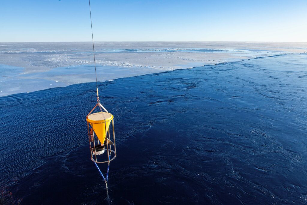
We attach different instruments to the mooring line at different depths to profile the entire water column from surface to seafloor. CTDs (Conductivity-Temperature-Depth) measure salinity, temperature and pressure. Acoustic Doppler Current Profilers (ADCPs) measure how fast water is moving across an entire water column, using the Doppler effect of sound waves, like sonar.
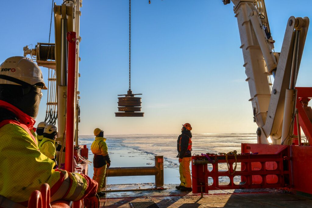
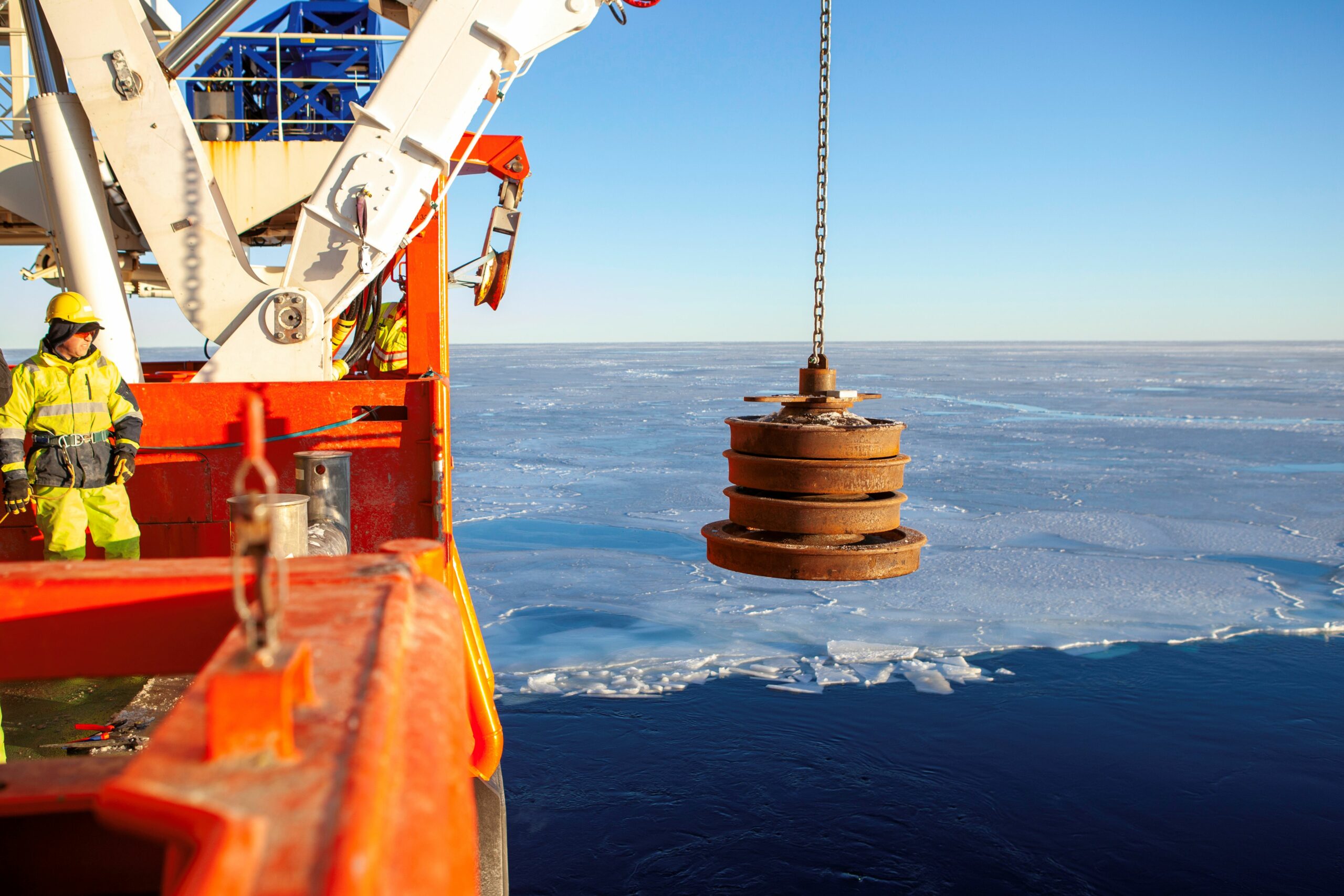
There’s a beacon at the bottom, near the anchor, so we can find the mooring again. The array is anchored with a heavy weight (usually old train wheels), with a release mechanism activated by a ‘pinger’. When the moorings were deployed, we ‘talked’ to them to triangulate the exact location where the mooring rests over the bottom. This way we know exactly where it is when we come back to pick it up.
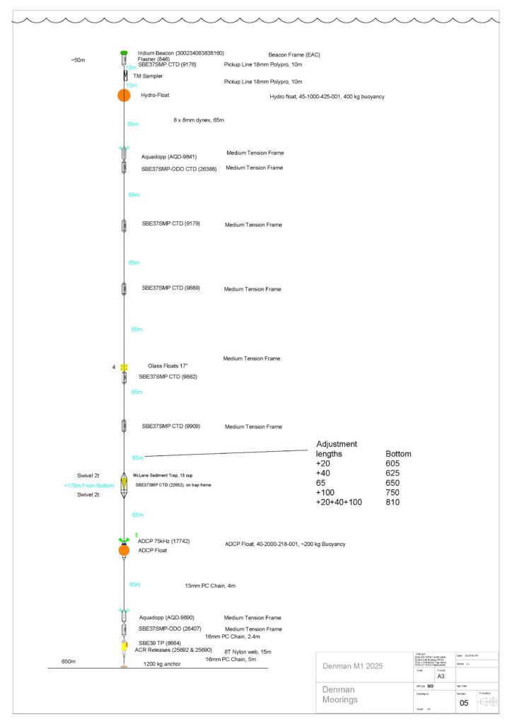
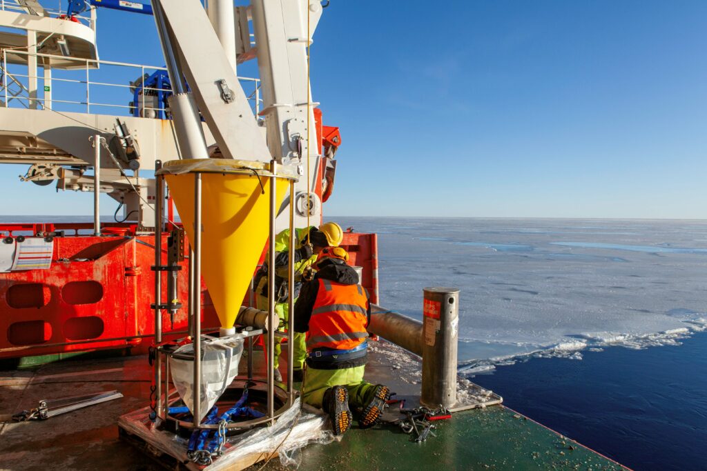
We successfully deployed three moorings on this voyage. One was a little different and more complex in that it has a sediment trap and a trace metal sampler. The trap is a large funnel designed to collect sediment sinking from the ocean surface to the deep ocean, with a rotating carousel that allows the collection of multiple samples.
The trace metal sampler will measure micronutrients, such as iron. The presence of these micronutrients limit how much phytoplankton can grow, and thus, how much carbon the ocean exports away from the atmosphere.
This more complex mooring enables study of the transfer of carbon and nutrients to the ocean interior via sinking particles, also known as the biological carbon pump. We are also interested in the ‘transfer efficiency’, which is the fraction of organic matter that remains after being consumed as it travels between the surface layers and depth.
This ‘biogeochemical’ mooring has been deployed into the Shackleton polynya. Polynyas are regions of open water surrounded by sea ice. Polynyas are ecologically significant, supporting a variety of marine life, including algae, plankton, and larger animals. As winter-time ‘sea ice factories’ producing dense water that sinks, polynyas also play an important role in ocean circulation and heat exchange with the atmosphere.
Why a mooring?
One of the hardest variables to observe in the ocean are ocean currents. That is because the ocean moves in ‘layers’, and the ocean surface does not necessarily move as the ocean bottom does. So remote sensing is not useful for us in this context. We need to go on a ship and measure ocean velocity directly. We combine ocean heat content with velocity to calculate ocean heat transport, and thus, basal melt rates: the rate at which ice shelves melt from below due to contact with warmer ocean water.
We’ve known for some time that the Southern Ocean is driving the observed Antarctic ice mass loss (e.g. Pritchard et al., 2012). So, any changes in the Southern Ocean circulation and heat content will affect how much and how fast Antarctica will contribute to sea level rise by 2100 and beyond.
Circumpolar Deep Water is an important ocean layer in this story. It upwells from the deep Southern Ocean towards Antarctica, and because it is salty and dense, it flows along the deepest parts of the seafloor that extend under the ice shelves.
We know that Circumpolar Deep Water is responsible for the current West Antarctic ice mass loss. For East Antarctica, we know Circumpolar Deep Water has warmed up to 3oC and is now 100-200 km closer to the continent than 50 years ago (Herraiz Borreguero and Naveira Garabato, 2022).
Thus, if we are to understand how the Antarctic Ice Sheet will respond to current climate warming, we need to document how Circumpolar Deep Water interacts with Antarctica over time, and what the impact of such interaction is to Earth’s climate system (e.g. Li et al., 2023).
Not surprisingly then, during this voyage we’ve deliberately targeted areas where we’ve found the flows of Circumpolar Deep Water are dominant.
Deployment
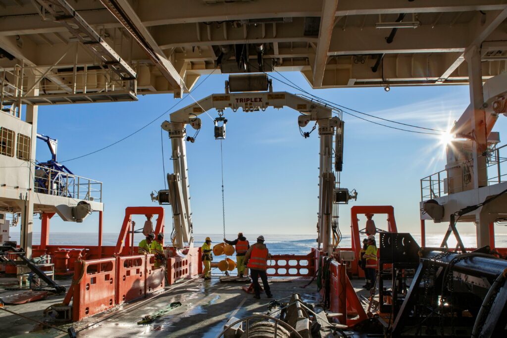
We chose a day of very good weather to deploy two moorings. But in Antarctica, everything can change rapidly, so we kind of expect things to vary in one way or another. And that’s exactly what happened!
The gear officers, the ship’s master and I had been discussing the deployment method and how we were going to communicate and interact with the crew during the week and days prior to deployment.
We started with a very chilly but pleasant morning, with a bit of very thin ice around us. We had started deploying our first mooring when the conditions deteriorated. The day turned into one of those days that you just don’t want for mooring deployment: windy, snowy, ice chunks, icebergs and a very strong ocean current moving everything around. We pulled the equipment we had already deployed in the water back onboard. We took a break to consider our options and gave it another go.
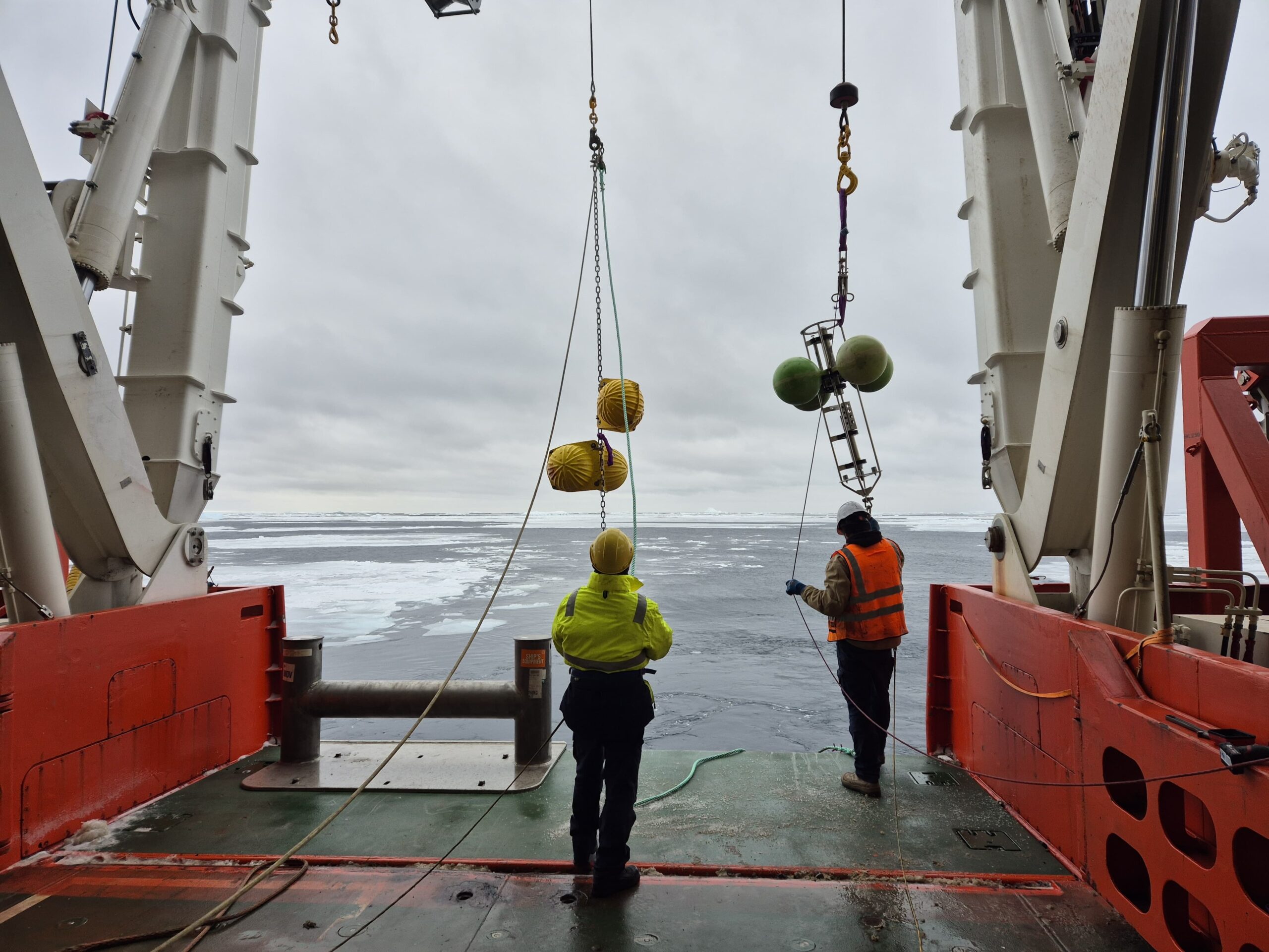
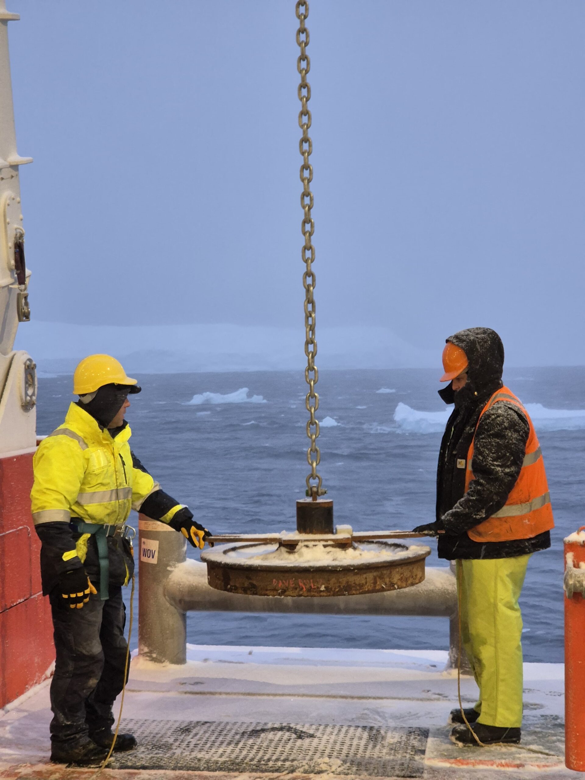
Jamie, our CSIRO gear officer onboard, led the successful deployments with determination, with the aid of the other two gear officers onboard, Trent and Adam, and the RSV Nuyina crew.
Each instrument in the mooring is carefully connected to the rope/chain and lowered into the ocean. Jamie lets us know when he’s ready for the next instrument and, with the help of the crew, we bring the instrument to him and Trent/Adam. We also check that the right instrument is brought forward at the right time, and the sequence is correct.
This is one of those moments when you really appreciate the role everyone plays in getting the observations needed to achieve the scientific goals for the Denman Marine Voyage, under very challenging environmental conditions, in a professional and safe way. Thank you, team!
Recovery
Now the moorings are underwater, we must wait patiently for a couple of years before we can recover them and their data, to discover new processes that will tell us more about how vulnerable the Denman glacier is to climate change.
In the meantime, we’ll be analysing the data collected so far from our CTD rosette and its many deployments across the front of the Denman Glacier and the western side of the Shackleton Ice Shelf.
References
Pritchard, H., Ligtenberg, S., Fricker, H. et al. (2012) Antarctic ice-sheet loss driven by basal melting of ice shelves. Nature 484, 502–505
Herraiz-Borreguero, L., Naveira Garabato, A.C. (2022) Poleward shift of Circumpolar Deep Water threatens the East Antarctic Ice Sheet. Nat. Clim. Chang. 12, 728–734
Li, Q., England, M.H., Hogg, A.M. et al. (2023) Abyssal ocean overturning slowdown and warming driven by Antarctic meltwater. Nature 615, 841–847
FOLLOW THE VOYAGE BLOG HERE
Anchor goes in under perfect conditions (photo: Pete Harmsen) 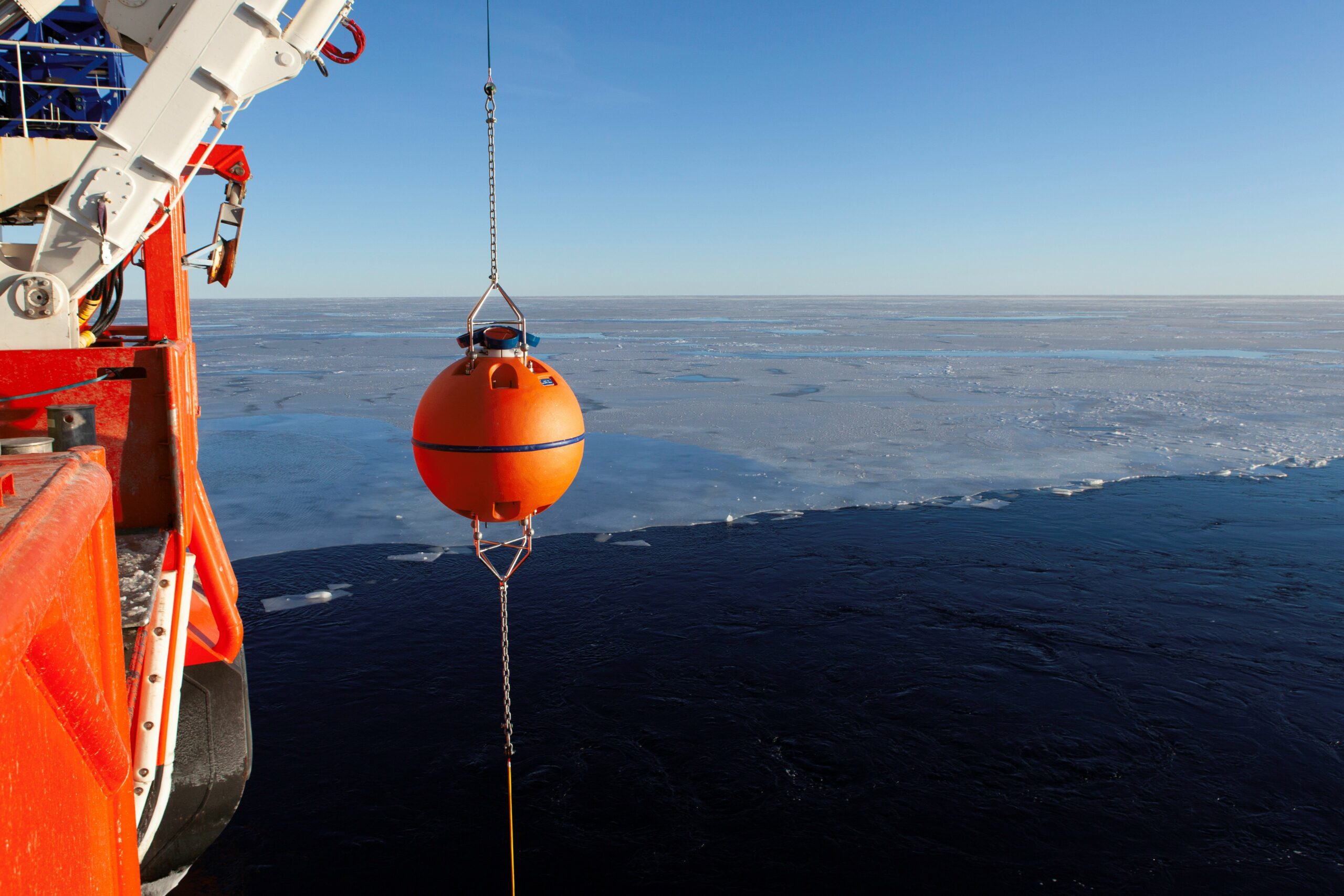
An acoustic current profiler with a float (photo: Pete Harmsen) 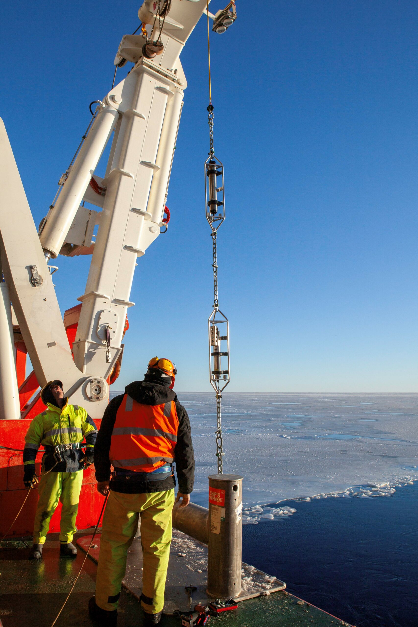
CTD and current profiler on a string (photo: Pete Harmsen) 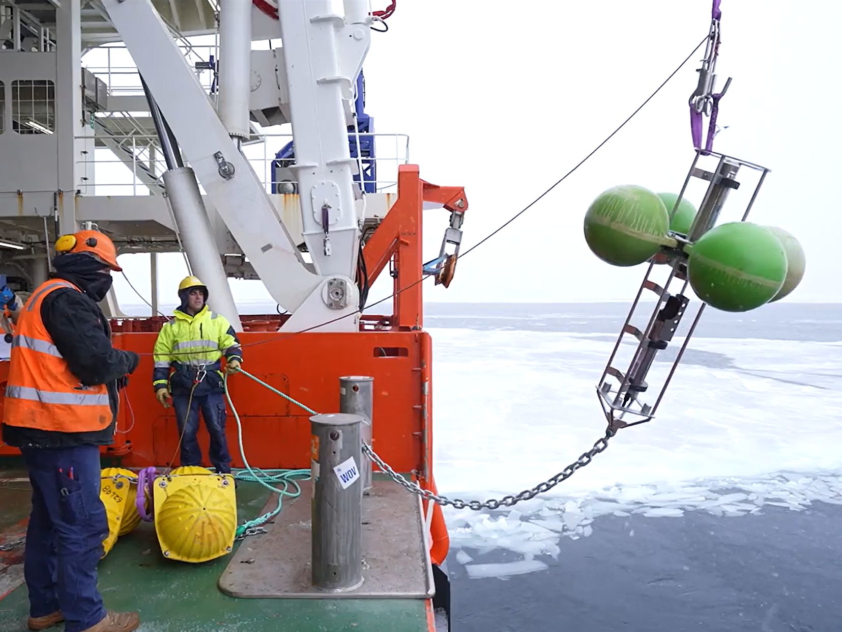
Floats with temperature/salinity/pressure sensors, on a difficult day (photo: Pete Harmsen) 
Acoustic current profiler (photo: Laura Herraiz Borreguero)
The Denman Marine Voyage is a collaboration between the Australian Antarctic Division (AAD), Securing Antarctica’s Environmental Future (SAEF), the Australian Centre for Excellence in Antarctic Science (ACEAS) and the Australian Antarctic Program Partnership (AAPP).