Scientists detect sudden loss of large Antarctic lake
MEDIA RELEASE
24 June 2021
Scientists in Australia and the United States are reporting the sudden loss of a large ice-covered Antarctic lake which held more water than Sydney Harbour.
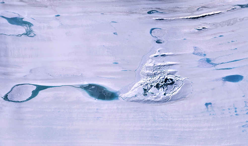
The rare event occurred during winter of 2019 on Amery Ice Shelf in East Antarctica and was noticed in satellite images the following summer by Dr Roland Warner from the Australian Antarctic Program Partnership at the University of Tasmania.
Dr Warner said that the event, detailed in a paper just published in Geophysical Research Letters, was most likely caused by a process known as ‘hydrofracturing’.
“We believe a large crack opened briefly in the floating ice shelf and drained the entire lake into the ocean within three days,” Dr Warner said.
“The lake held more water than Sydney Harbour and the flow into the ocean beneath would have been like the flow over Niagara Falls, so it would have been an impressive sight.”
Hydrofracture occurs when liquid water, which is denser than ice, exerts sufficient extra pressure on cracks in ice shelves to open them right through to the ocean below.
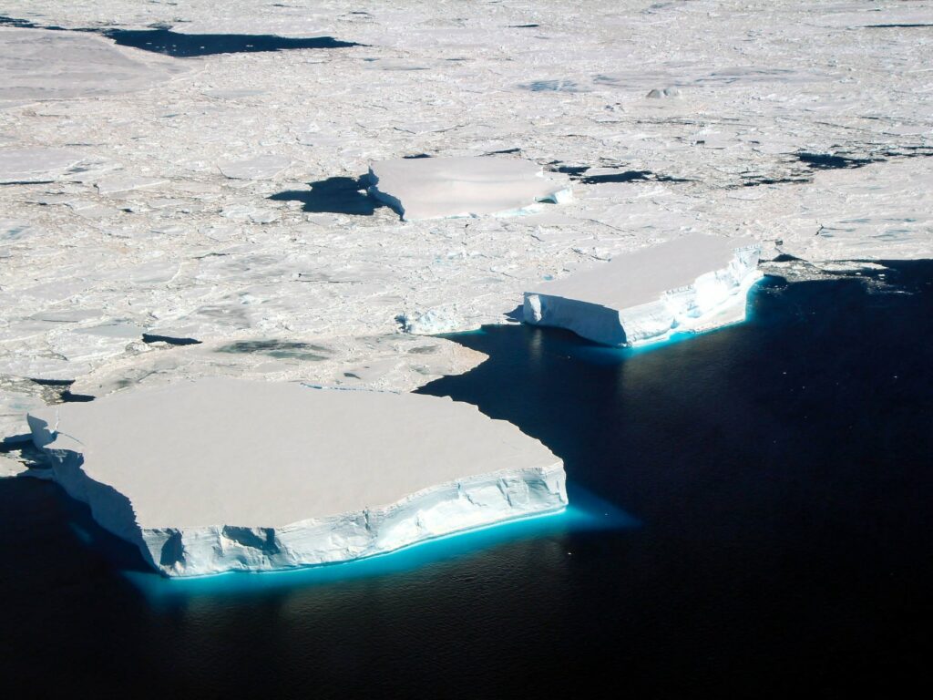
Multiple hydrofractures have been implicated in the collapse of smaller ice shelves in the Antarctic Peninsula, where plentiful melt-water forms on the surface during summer. It is rare to see hydrofracture through ice as thick as the 1400 metres on Amery Ice Shelf, and in the middle of winter.
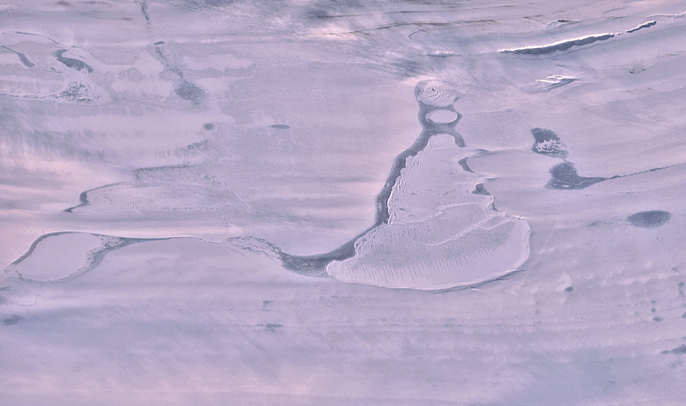
Drainage of the unnamed lake left behind a deep, uneven depression in the ice shelf surface covering about eleven square kilometres. This impressive feature, known as an ice ‘doline’ contained the fractured remains of the thick lid of ice that had covered the lake.
The event was also captured by a laser instrument on NASA’s ICESat-2, which detects individual photons reflected back from the ice surface to make high-resolution elevation measurements. Study coauthor Professor Helen Fricker at Scripps Institution of Oceanography, a member of the ICESat-2 Science Team said it was a great demonstration of the satellite’s capability.
“ICESat-2 orbits with exactly repeating ground tracks and comparing elevations before and after the lake drained showed us the dramatic vertical scale of the disruption,” said Prof. Fricker.
“It’s exciting that ICESat-2 can show us details of dynamic processes, from the elevation changes across the doline down to the fine scales of the meltwater processes that followed.”
The team also used surface elevation maps generated by the Polar Geospatial Centre at the University of Minnesota to explore the full extent of the changes, stretching across sixty square kilometres.
“The deepest part of the cavity is 80 metres lower than the original lake surface, even though the ice shelf surface rose by as much as 36 metres around the lake,” Dr Warner said.
“The loss of lake water locally reduced the weight on the floating ice shelf so that ocean pressure lifted it upwards at the doline.”
The surface uplift even created a new lake basin out of a shallow arm of the original one. From the volume of the cavity and the amount of uplift, the team estimated that 600 to 750 million cubic metres of water had been lost to the ocean.
While Amery Ice Shelf does have many melt lakes and streams in summer, the volume lost is also many times the annual meltwater in the catchment that fed the lake.
Professor Jonathan Kingslake and Julian Spergel from the Lamont Doherty Earth Observatory at Columbia University brought the project their expertise in measuring surface meltwater lakes using data from the Landsat 8 satellite.
The summer of 2020 saw meltwater fill the new lake within a few days at more than a million cubic metres per day and overflow into the doline cavity. When ICESat-2 crossed the doline again, just days after the overflow began, it showed that meltwater had cut a new channel twenty metres wide, detecting the water level at three metres depth, and photons scattered from the stream bed a further three metres below.
Dr Warner said the future of the new doline was not certain.
“It might accumulate meltwater again or drain to the ocean more frequently. It does appear that the fracture reopened briefly during the 2020 summer melt season, so it is certainly a system to watch.” said Dr Warner.
“This event does raise new questions about how common these deep ice-covered lakes are on ice shelves and how they evolve.”
In recent decades, some Antarctic ice shelves have experienced greater surface melting with rising air temperatures, and the most recent projections of the consequences of future warming for Antarctica show that trend continuing and creating more melt lakes. This is recognised as increasing the risk of widespread hydrofracturing which could lead to ice shelves collapsing, permitting faster discharge of ice from the grounded ice sheet and future increases in sea level.
However, the authors caution against connecting the drainage of this lake to these broader climate trends.
“This abrupt event was apparently the culmination of decades of melt-water accumulation and storage beneath that insulating lid of ice,” said Prof Kingslake.
“However, increasing amounts of meltwater flowing into deep, ice-covered lakes and causing hydrofracture of thick ice shelves should also be considered in assessments of Antarctica’s future.”
Warner, R. C., Fricker, H. A., Adusumilli, S., Arndt, P., Kingslake, J., & Spergel, J. (2021). Rapid formation of an ice doline on Amery Ice Shelf, East Antarctica. Geophysical Research Letters, 48, e2020GL091095. https://doi.org/10.1029/2020GL091095