Diving deep: Exploring the Denman Glacier with CTDs
9 April 2025 — by Yuhang Liu, AAPP
Deciding where to deploy
Oceanography is the scientific study of the ocean, encompassing its physics, chemistry, biology, and geology. It’s an interdisciplinary field that investigates the ocean’s processes and interactions with the environment.
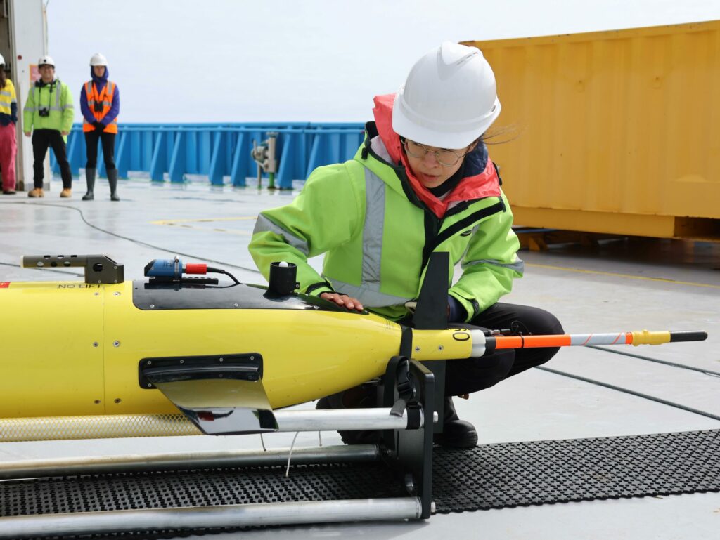
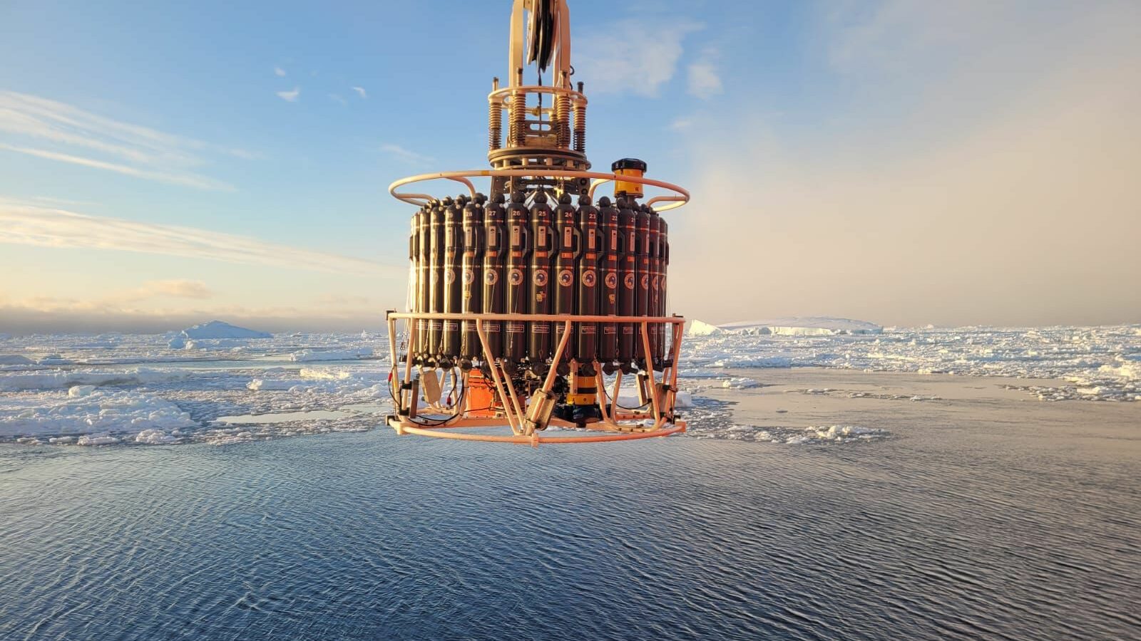
CTD (short for Conductivity, Temperature, and Depth) is the primary oceanographic instrument used during the Denman Marine Voyage and a long-standing staple for oceanographers at sea. It provides highly accurate measurements of temperature and conductivity (used to calculate salinity) at any depth.
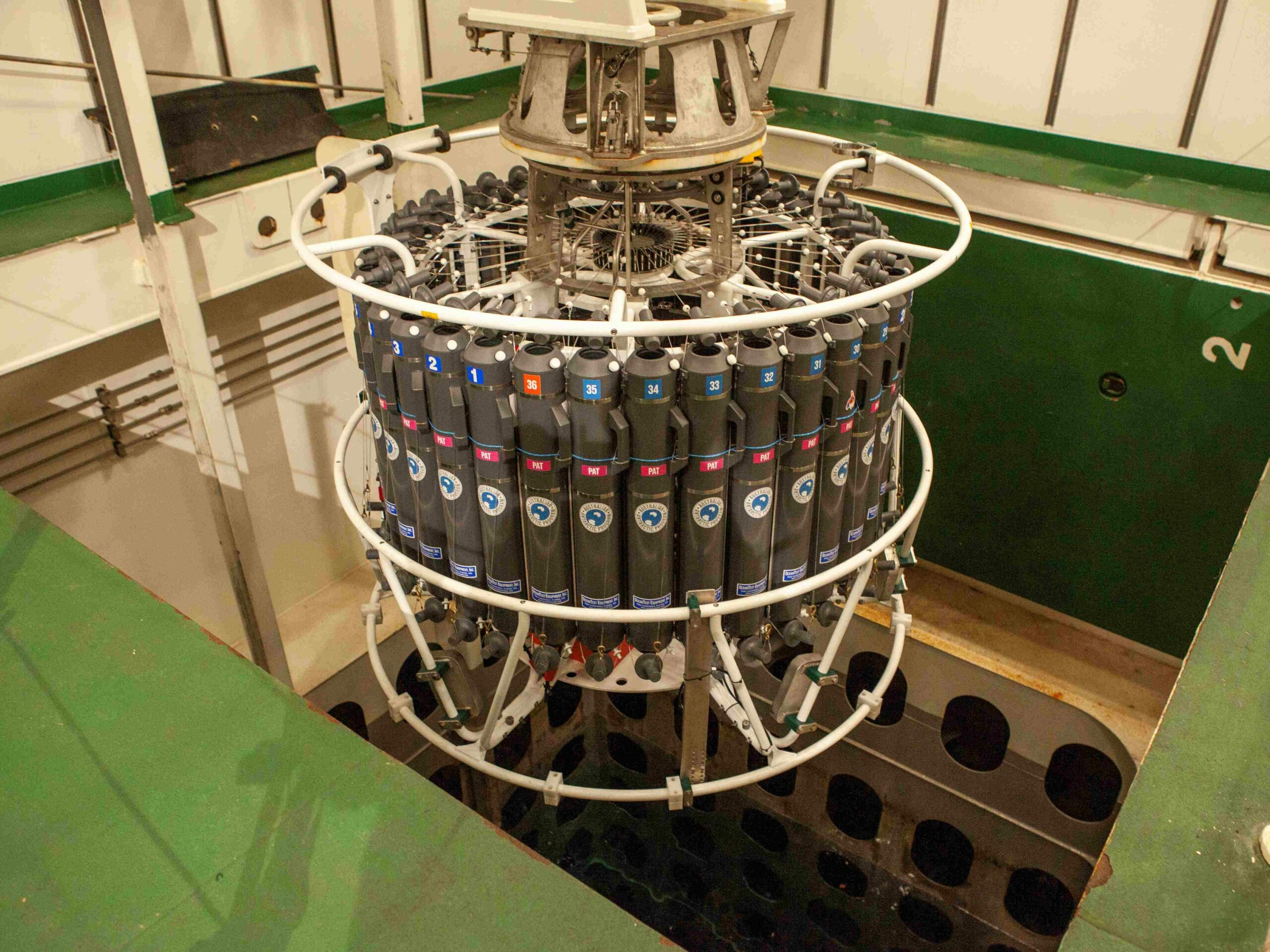
The CTD is mounted on a circular metal frame called a rosette, which holds up to 36 Niskin bottles — each with a capacity of 12 litres for water sampling. Alongside the Niskin bottles, the rosette is equipped with multiple sensors, such as Acoustic Doppler Current Profilers (ADCPs) to measure current velocity, an oxygen sensor for dissolved oxygen, and a fluorescence sensor to detect chlorophyll levels.
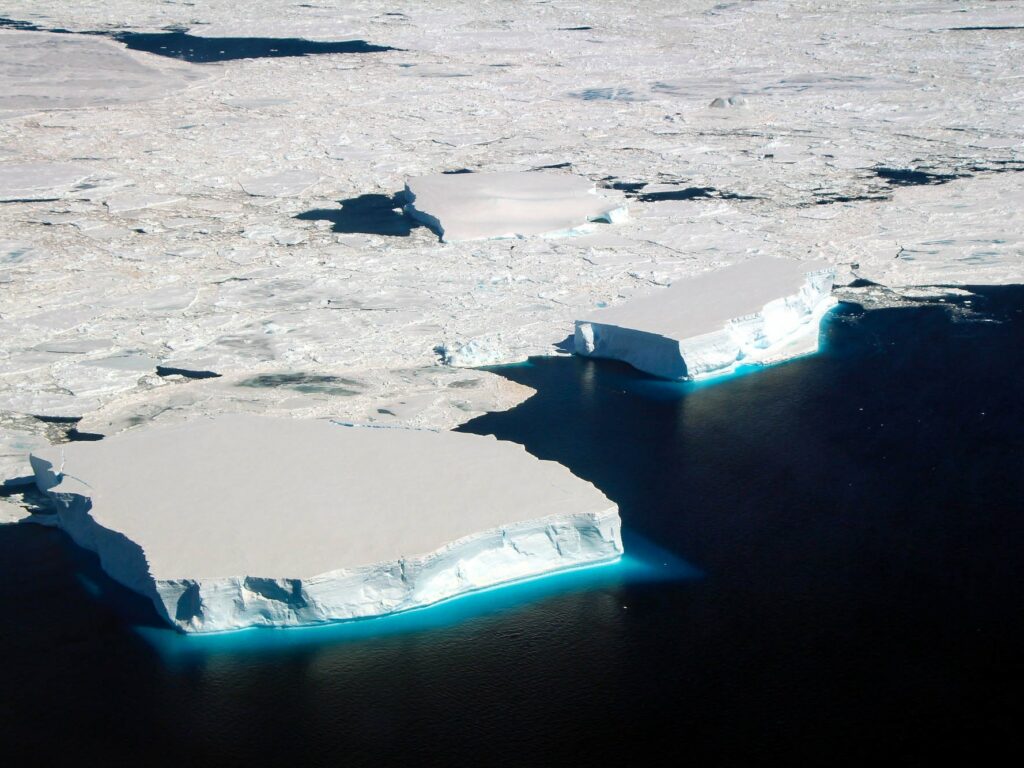
Antarctic ocean water comes in a range of ‘flavours’, and ‘water masses’ are defined by their properties of salinity, density, temperature and chemical composition. Oceanographers chase where the energy (e.g. heat) is and how it impacts ocean circulation and ocean heat transport.
In the Denman Marine Voyage, we’re chasing how a particular water mass, Circumpolar Deep Water (CDW), interacts with the Denman and Shackleton ice shelves. This interaction determines how much ice the ice shelves lose due to ocean heat. We also chase where the melted ice, or glacial freshwater, goes, as this changes the density of the ocean and, thus, the way the ocean moves and transports heat and other things like nutrients and atmospheric gases.
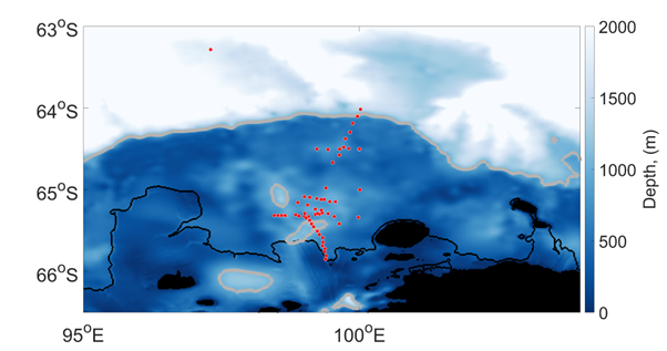
For this reason, each CTD station depends on the CTD next to it, so that we capture the physics of the ocean as it happens. Our CTDs cluster along lines or sections, and how close together each CTD is (~5km) is set by the Earth’s rotation at our current location. This way we get continuity — what we observe in one CTD is related to what we observe in the next. With these sections (right: red dots are CTD stations), we can detect strong currents and other features, such as eddies. These currents and eddies can either protect an ice shelf from melting, or not.
This is but one of the features we’re trying to capture around the Denman-Shackleton glacier-ice shelf system.
Why do we care? We know that when a floating ice shelf thins or breaks into pieces, the ice sheet resting on bedrock moves faster towards the ocean. This means more ice ends up in the ocean, thus, increasing global sea level rise. Our aim is to help improve predictions of how much sea level rise the East Antarctic Ice Sheet will contribute to by 2100 and beyond.
CTD deployment
During the deployment the crew, technical support staff and oceanographers become one. Communication at all stages of the deployment is essential to guarantee the quality of measurements and safe operations.
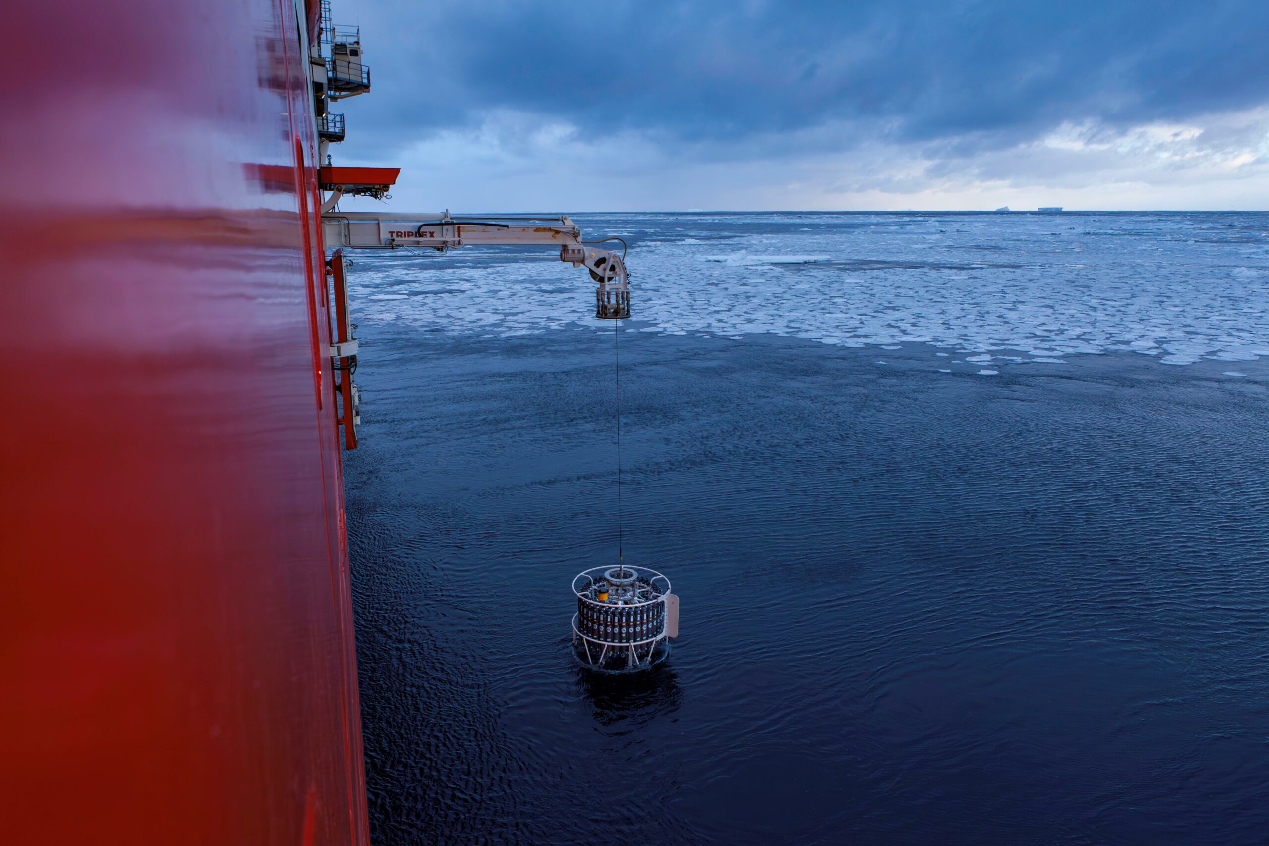
The CTD is deployed from the side door of the ship using an extendable gantry and lowered by a long cable. In the operations room, we monitor live sensor data from the rosette as the CTD descends, approaching the bottom with care and deciding the stops where Niskin bottles will close and water will be collected.
In this voyage, some stations request water samples for up to 21 different variables. The operations room is the most thrilling place to be, as we determine the depths needed to satisfy multiple research groups. We also ensure duplicate depths are sampled to guarantee enough water for everyone’s experiments onboard.
As the CTD approaches the bottom, we communicate with the winch operators to maintain a clearance of 5 to 20 metres from the sea bottom—nobody wants the instrument crashing into the seafloor! But it’s tricky. The ship is drifting, swaying with swell, dodging icebergs, and battling big waves, so direct communication between scientists and winch operators is essential.
The winch speed is just as crucial—too fast, and the water column gets disrupted; too slow, and the Antarctic water (always freezing!) might turn the instruments into an icy pole. On the way back up, we carefully fire the bottles from the operation room. And yes, “firing” is as serious as it sounds—one wrong move or a misfire can ruin the entire deployment!
Through the moon pool
While CTD deployment traditionally occurs from the side door of the ship, we also have a backup plan: the moon pool (above). This alternative is used in bad weather and sea ice conditions, such as those encountered on the Denman Voyage. The moon pool is a 4m x 4m opening through the hull, featuring two hydraulic upward-opening doors at the bottom to prevent ice ingestion and two downward-opening doors at Deck 4 level. This setup allows the CTD to be lowered through the moon pool using the CTD winch, even in challenging environments. Before reaching the Shackleton Ice Shelf, we successfully conducted three moon pool deployments.
Water sampling
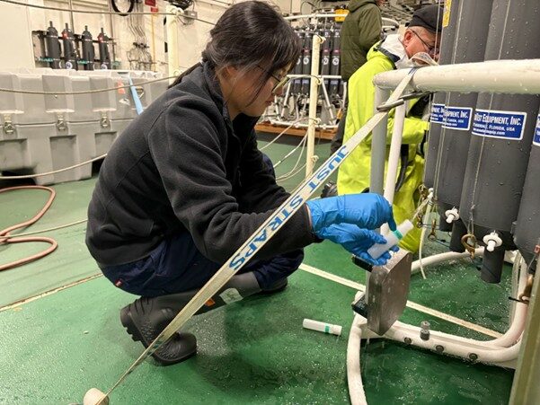
Water sampling is one of the most fun and hands-on parts of CTD deployments. It’s often accompanied by music, bottle-shaking dance and various containers ranging from tiny tubes to big buckets. For oceanographers who spend most of their time staring at computer screens, it’s a rare chance to get salty, wet and cold.
Our main tasks include collecting samples for dissolved oxygen, salinity, and nutrients.
Afterwards, the hydrochemistry lab works hard to analyse and recalibrate the CTD sensor data.
Every sample is delicate and must be handled with care. Each bottle is rinsed at least three times to avoid contamination. There’s a strict sampling hierarchy—gases are collected first since bubbles are the enemy of accurate dissolved oxygen measurements.
CTD deployments are still underway — our team has done more than 60 in front of the Denman Glacier so far — and we’re expecting more sections to be done as we move into the western part of the Shackleton Ice Shelf!
The Denman Marine Voyage is a collaboration between the Australian Antarctic Division (AAD), Securing Antarctica’s Environmental Future (SAEF), the Australian Centre for Excellence in Antarctic Science (ACEAS) and the Australian Antarctic Program Partnership (AAPP).
FOLLOW OUR VOYAGE BLOG HERE