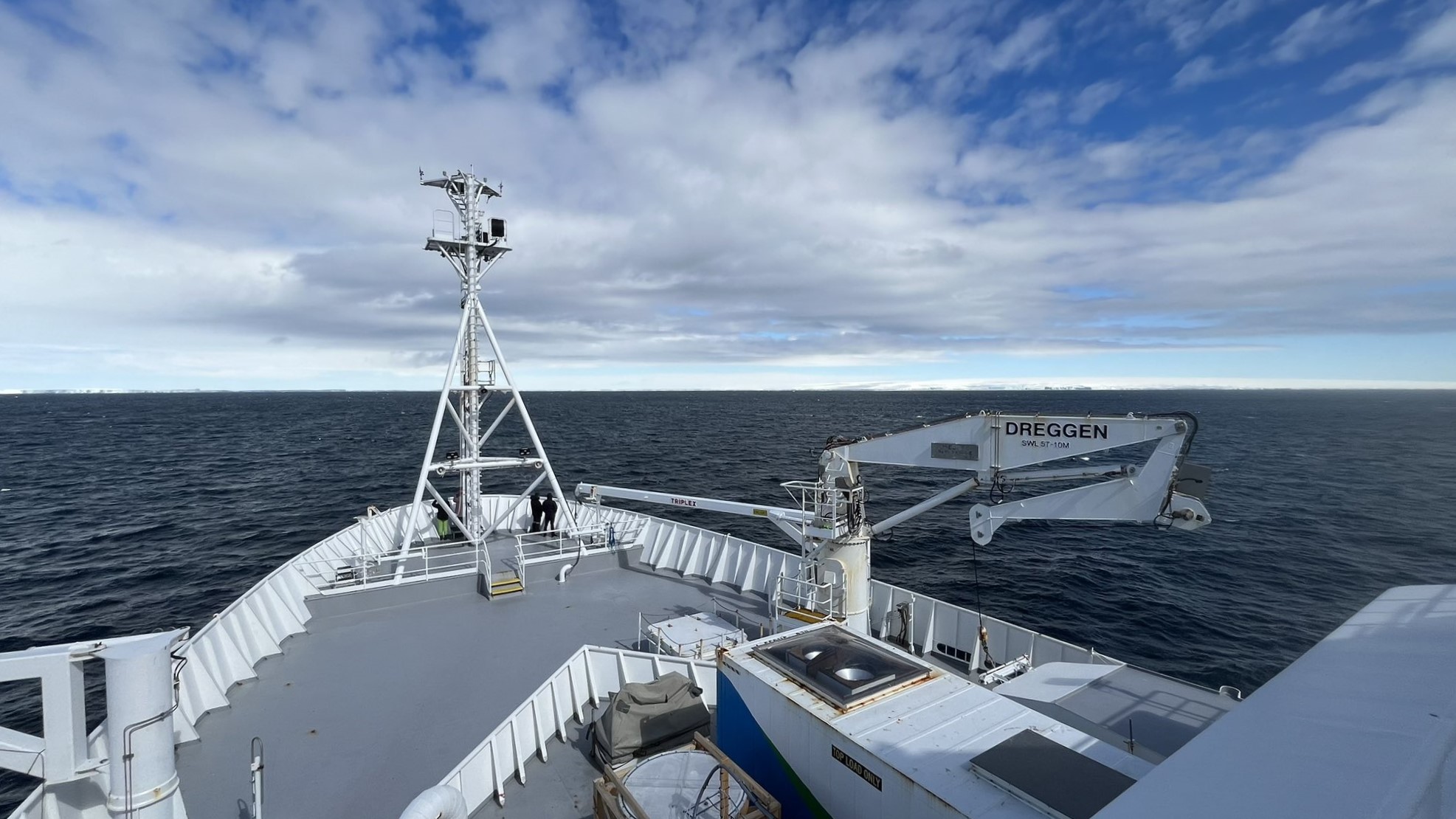
How to measure an ocean?
Dr Annie Foppert, Co-Chief Scientist, MISO voyage
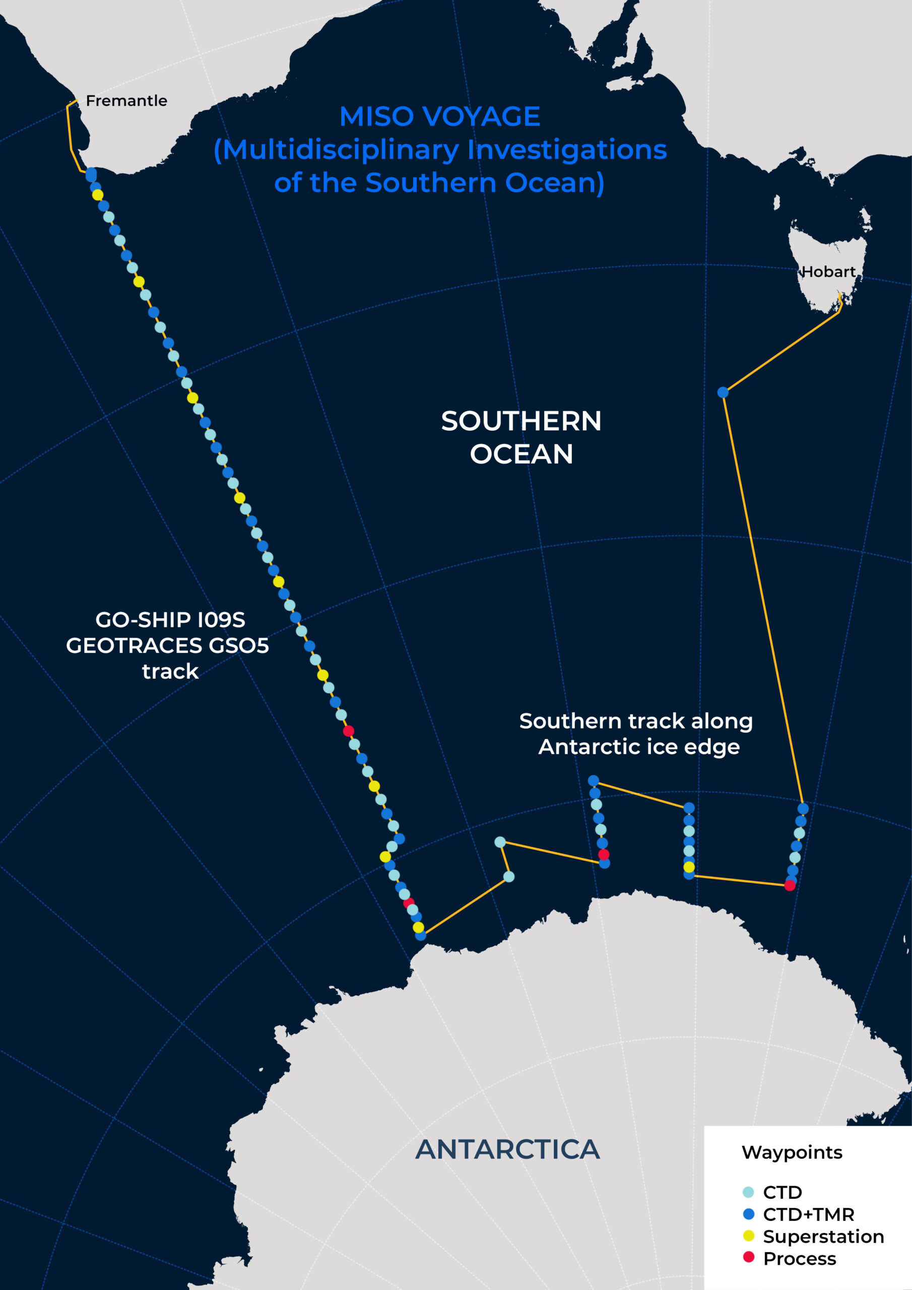
A key aim of our MISO voyage is to collect data that can be compared to earlier measurements, so we can track how the Southern Ocean is changing. That means taking ocean measurements (or ‘occupying stations’) in places research ships have been to previously.
Our voyage path from Hobart to Fremantle on CSIRO research vessel (RV) Investigator has basically two parts: firstly, the southern track along the Antarctic margin below 60°S; and secondly, we sail up longitude 115°E across the entire ocean basin all the way from Antarctica to Western Australia, along what’s known as a ‘repeat line’ (marked as GO-SHIP I09S and GEOTRACES GSO5 on the map).
GO-SHIP stands for Global Ocean Ship-based Hydrographic Investigations Program, an international network to coordinate a global climate/ocean observing system. The GO-SHIP I09S line was last measured, or ‘occupied’, in 2012.
GEOTRACES is an international study of the marine biogeochemical cycles of key trace elements and isotopes. Taking trace metal measurements along the GS05 line is our voyage’s contribution to this international program.
The idea is to gain an updated view of how the large-scale oceanography and biogeochemistry is evolving. How has the overturning circulation changed? How much human-emitted CO2 is being absorbed by the ocean? How are the levels and types of trace metals (like iron and zinc) changing?
As we follow these survey lines, at each waypoint we’re measuring the ocean with one of four different types of stations (indicated on the map), each more complex than the last:
- CTD-only stations, to full depth (CTD stands for Conductivity-Temperature-Depth instrument, a large steel frame lowered from the ship carrying bottles that collect water at different depths and a range of sensors)
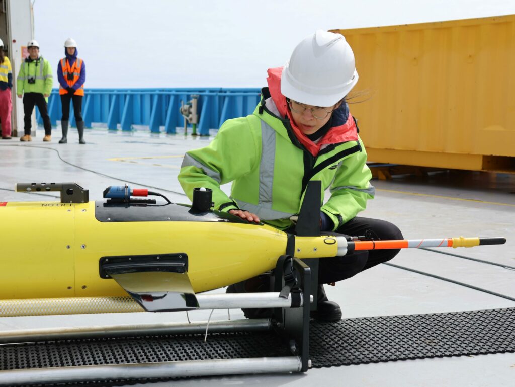
- CTD and TMR stations (TMR is the trace metal rosette, like a CTD but handled in a ‘clean’ way to prevent metal contamination of samples by ship, cable or people)
- ‘Superstations’ are a combination of CTDs, TMRs (shallow and deep to get higher resolution in the upper ocean), in-situ pumps (which filter water at set depths to measure the particulate trace metals), and bongo net tows (to collect zooplankton)
- Process stations: we plan to do four of these, where we’ll follow a patch of water for around three days to understand how the biology at the ocean’s surface is linked to the aerosols in the atmosphere above that seed clouds over the Southern Ocean.
On the deck, we’re also growing phytoplankton in incubation tanks as ‘mesocosm experiments’, to study the evolution of the phytoplankton communities over about 10 days under control and iron-fertilised scenarios.
While at these stations, the atmospheric team is continuously measuring several components of the atmosphere, including aerosols, clouds, radiation, and precipitation.
To help fill gaps in observations, we’ll deploy 12 Deep Argo floats capable of measuring the full ocean depth, from sea surface to sea floor, and 10 BGC Argo floats (as part of the Southern Ocean Carbon and Climate Observations and Modelling project, or SOCCOM) to measure the upper 2000 metres of the ocean with biogeochemical sensors.
That’s plenty to be getting on with! We’ll keep you posted.
This research is supported by a grant of sea time on RV Investigator from the CSIRO Marine National Facility which is supported by the Australian Government’s National Collaborative Research Infrastructure Strategy (NCRIS).