In the land of frozen giants
Julia Neme (UNSW Climate Change Research Centre)
During this MISO voyage on CSIRO research vessel (RV) Investigator, we’ve had the amazing opportunity to be surrounded by a really diverse sea-icescape, with a large variety of icebergs and wildlife around the Antarctic margins. Our traverse from 150°E to 113°E has been rich in scenery, which we were able to enjoy thanks to some out-of-the-ordinary good weather.
As we transited south I could feel the air becoming colder and drier, an indication of the closeness of the continent. In anticipation, we placed our bets for the latitude and time at which we would see the first iceberg, which turned out to be at 60°S on 10 January at 10:30am. We all ran outside to see (what was for many of us) our first bit of frozen water. Only that it wasn’t a “bit”, it was a huge tabular iceberg!
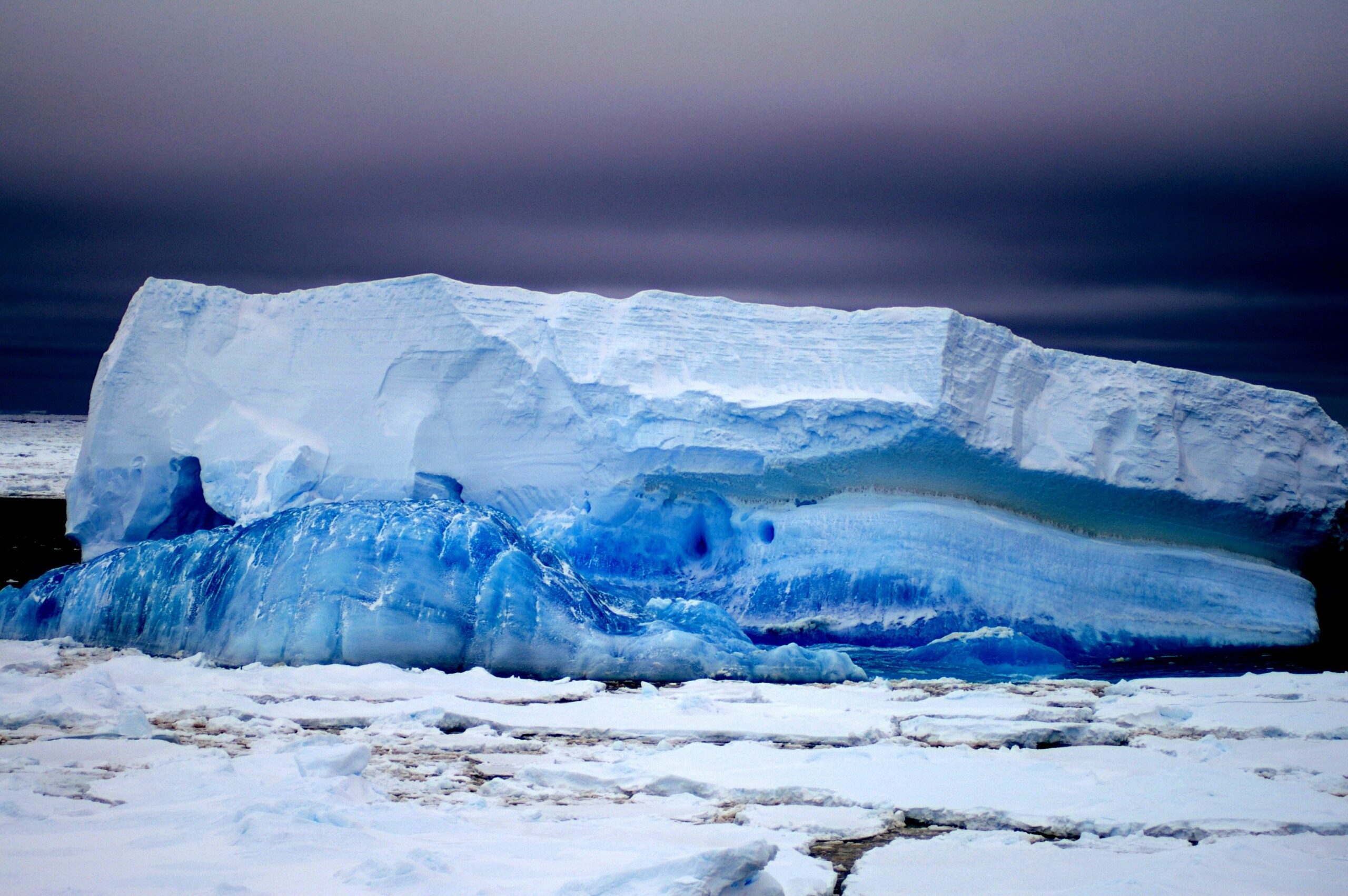
Icebergs are pieces of ice that have broken off a continental glacier, and drift in the ocean pushed by currents and winds. A tabular iceberg is one with steep, wall-like sides and a flat top, usually quite new and not shaped by erosion or melting. After this first one, we continued to regularly sight iceberg after iceberg with more diverse shapes and sizes starting to appear, including one shaped like a boat with holes that resembled windows and columns. This one had blue-coloured sections, which usually indicates less air bubbles trapped in the ice.
When icebergs are close enough, or if you look at them through binoculars, they are stunning. One of the first things that struck me was the layered structures in their walls that tell a story of the ice shelf formation. There are layers upon layers of compressed snow of increasing density, tilted if the iceberg has melted unevenly and ended up lop-sided. You can also see how different elements have shaped the icebergs’ texture. The section of the iceberg below the water line is often smooth in comparison to above, where wind erosion gives it a more rugged surface. Sometimes they’re peppered with holes that are large enough to reveal the deep blue of the interior.
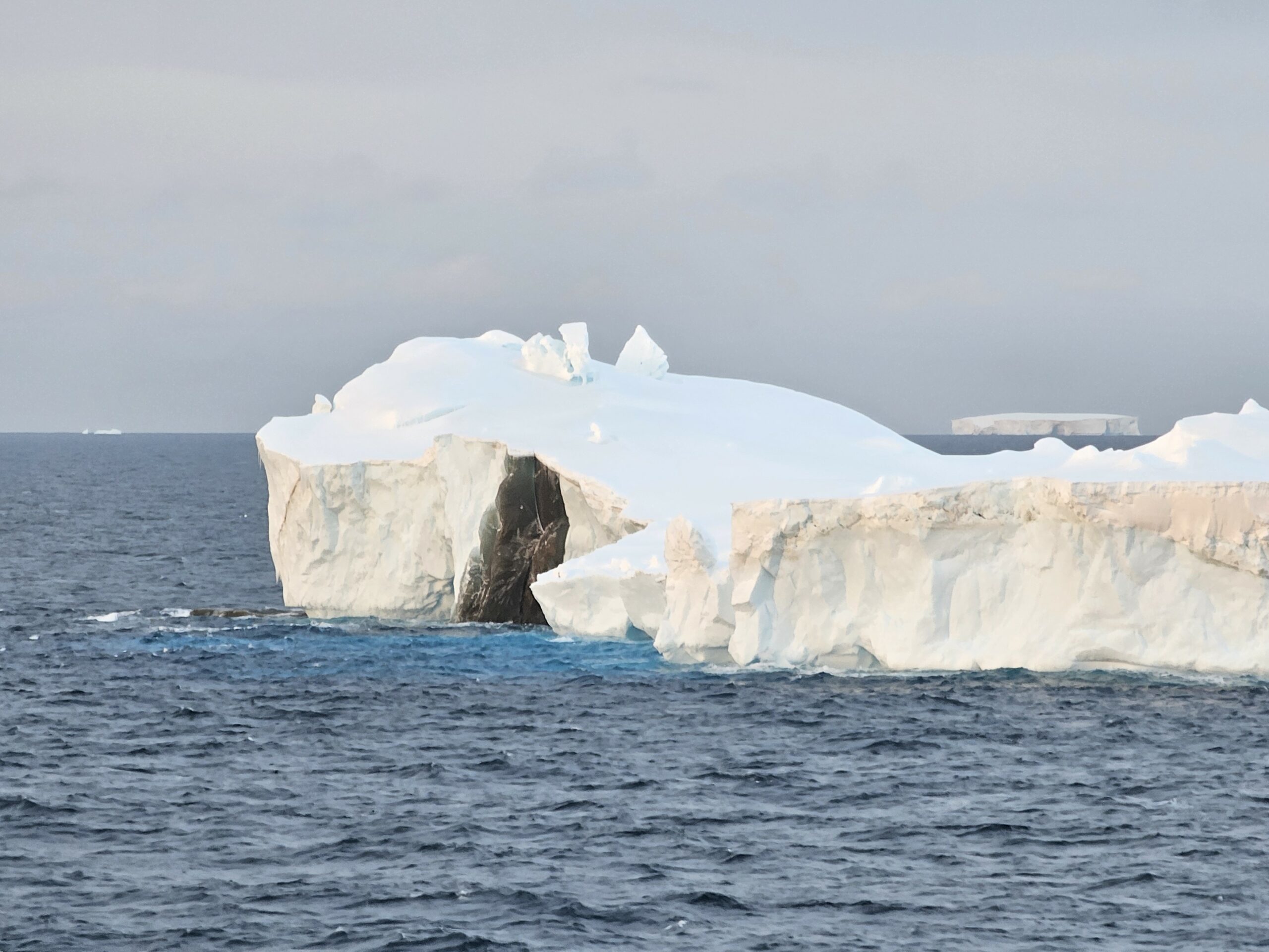
As we moved closer to the Mertz glacier, the icebergs started to become more massive. If icebergs are large and deep enough, they become “grounded” on the seafloor and stop drifting, with smaller icebergs and sea ice gathering around them. We sailed by the edge of B9B, a grounded iceberg calved from the Ross Sea in 1987 but still alive and thriving in this region. B9B’s surface area is over 600 km2!
This is also when we first arrived at the sea-ice edge. Unlike icebergs (pieces of ice shelf that have broken off), sea ice is formed by the freezing of water at the surface of the ocean. It’s generally smaller and more fragmented but still extremely cool. Amongst the sea ice is a prime spot to find resting penguins or seals (we saw one floe with over 20 penguins on it), and if you’re really lucky (like we were!) you may even see the orcas that feed on them. You can also see a greenish-brown colour on the underside of sea ice from the organic matter and phytoplankton (tiny photosynthesising cells) that form the base of the food chain in this area.
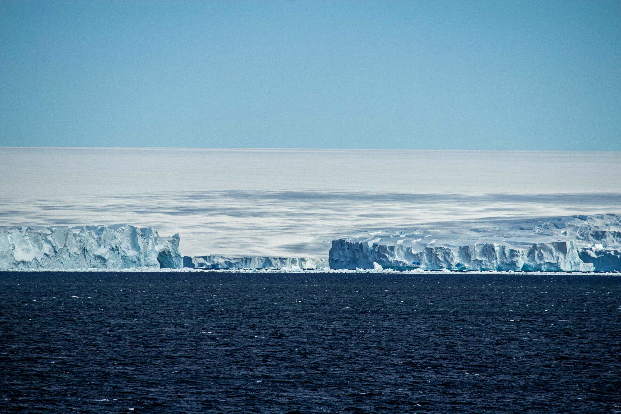
When we arrived at the front of the Mertz glacier we were incredibly lucky. The strong gravity-driven katabatic winds that flow down the slopes of the Antarctic continent blew away all clouds and mist so we could finally see the glacier and the continent clearly. This was a breathtaking view: the steep walls of the glacier contrasting with the smoother, wind-swept hills of the Antarctic coastline. Other voyages in the same location at the same time of the year never saw the continent because of fog and clouds and bad weather. So thank you katabatics!
As we said goodbye to the Mertz glacier and left the region, we headed west where the bad weather caught up with us. We had a 10-day period stuck in fog with icy decks preventing us from going outside. We felt as if we would be in cloud forever but finally the sun came out! As we emerged from the mist, we found ourselves surrounded by hundreds of icebergs more diverse in shape, size and colour than the colossal Mertz ones. This is because icebergs usually end up moving in the same direction as each other with the ocean’s movement, creating a “highway” for the drifting bergs. At one point we counted 167 surrounding us!
We even started seeing icebergs with black ice, possibly from terrestrial debris that became incorporated into the original ice shelf or glacier as it flowed past rock. There were also icebergs with grey-ish layers from sediment deposits. Due to melting, their shapes differed from the classic tabular icebergs. These had smooth domes, weathered surfaces, higher fin-like structures, columns, and more. When sailing through areas like this, ice navigators on the bridge keep an eye out along our course. They have different names for different types of ice: swans, growlers, bergy bits, large bergs, etc. The icebergs eventually stop drifting north due to counter-currents and finally end their journey in what is known as the iceberg graveyard.
We’re now heading north, leaving the land of frozen giants behind us. It has been amazing and for me, a once-in-a-lifetime opportunity, but it is time to continue our voyage in warmer waters. After weeks of sampling below-zero temperature waters, my hands are looking forward to our journey back home.
‘Black’ ice (photo: Francis Chui) 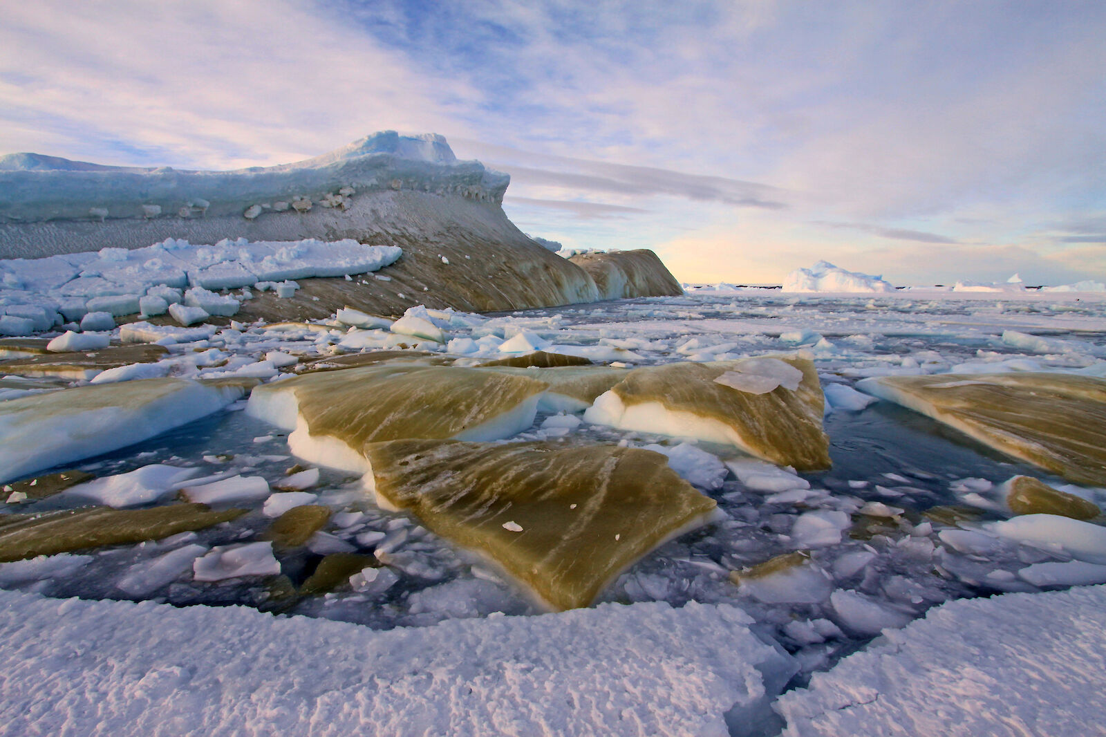
Recently tipped iceberg, greenish-brown from algae (photo: Kerry Steinberner) 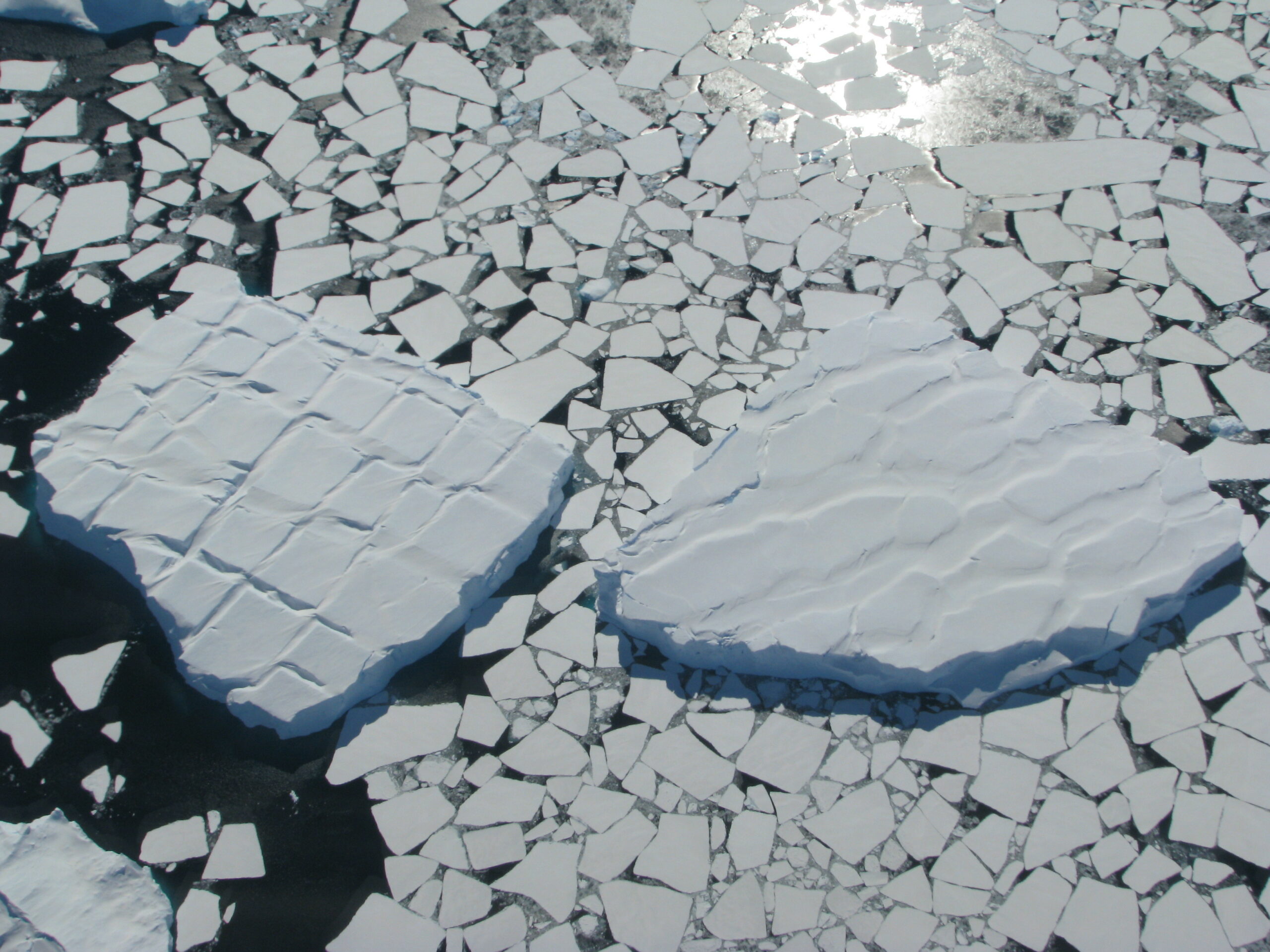
Sea ice and tabular icebergs (photo: Nisha Harris) 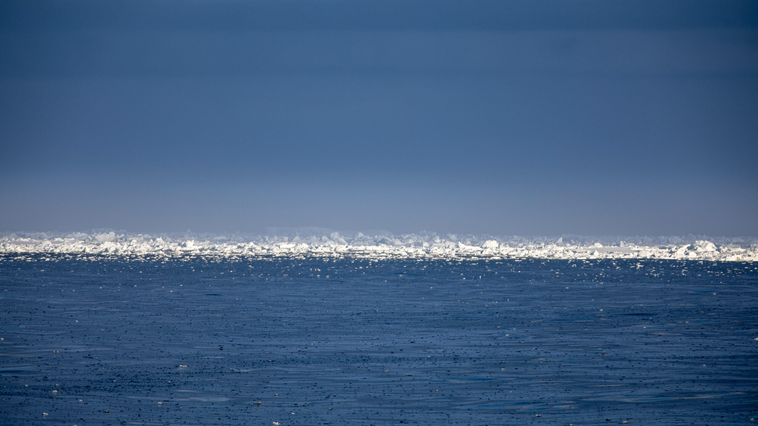
Bergy bits (photo: Knut Heinatz) 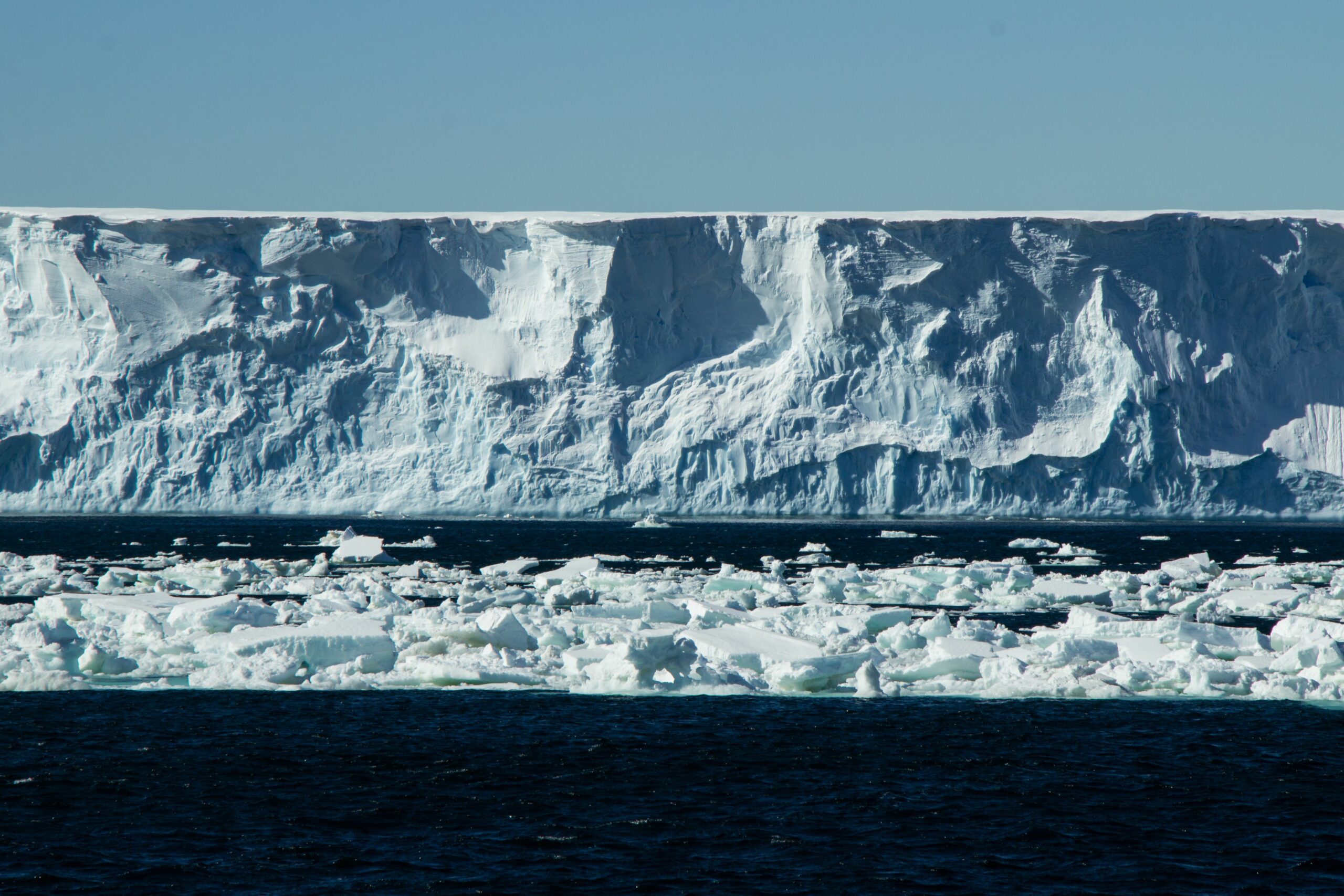
photo: Chris Traill 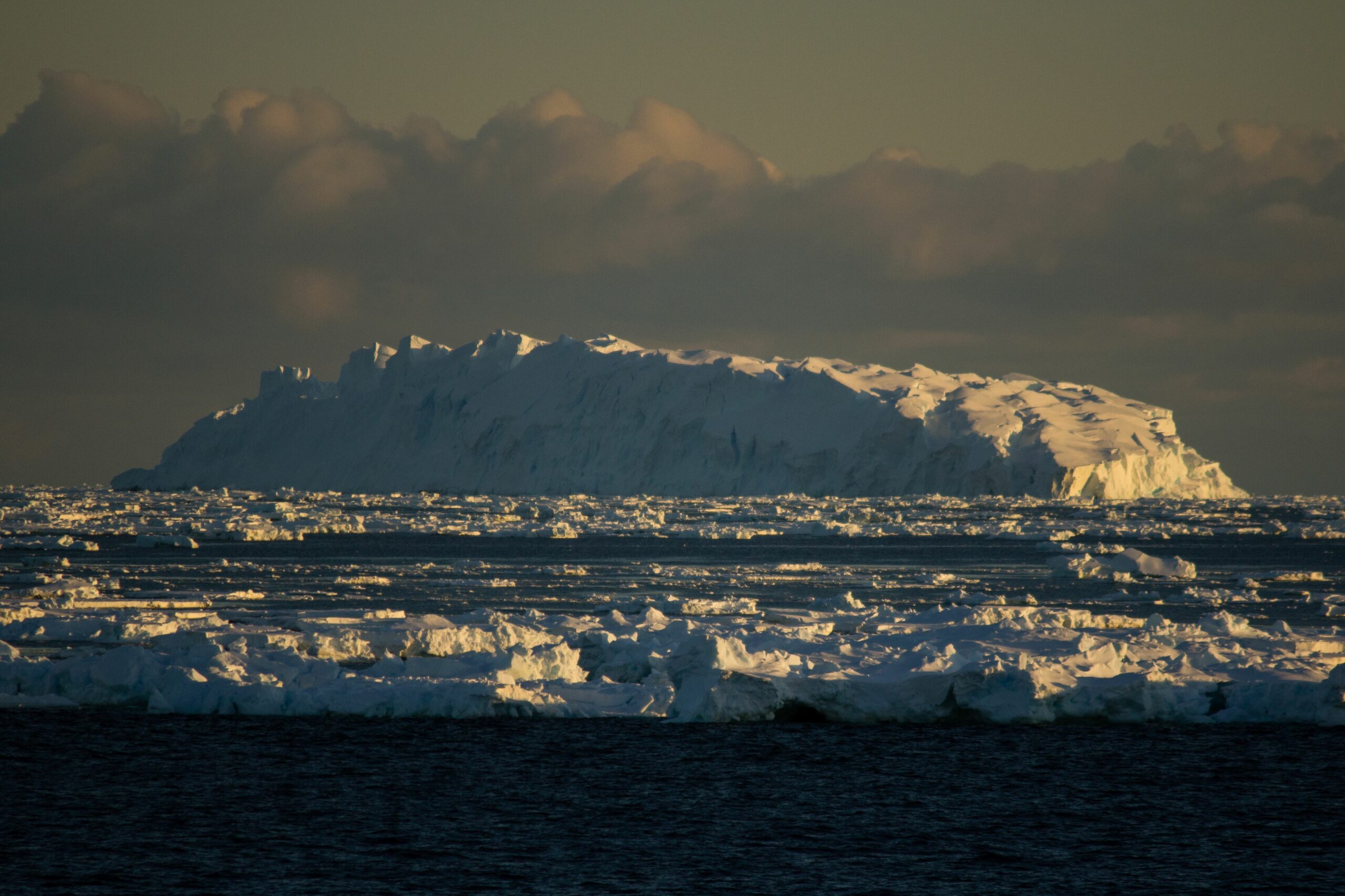
photo: Chris Traill 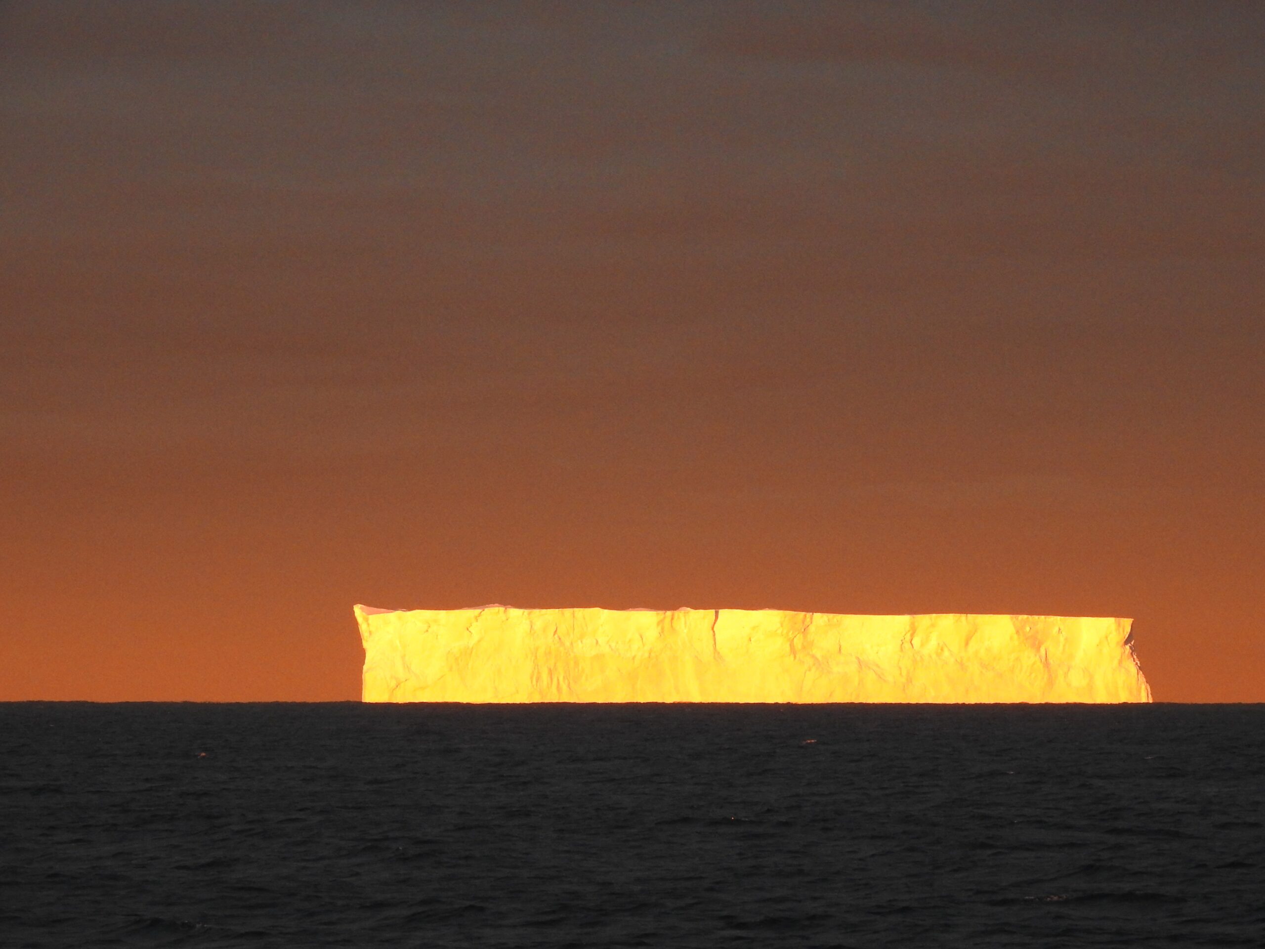
Tabular iceberg at sunrise (photo: Peter Shanks) 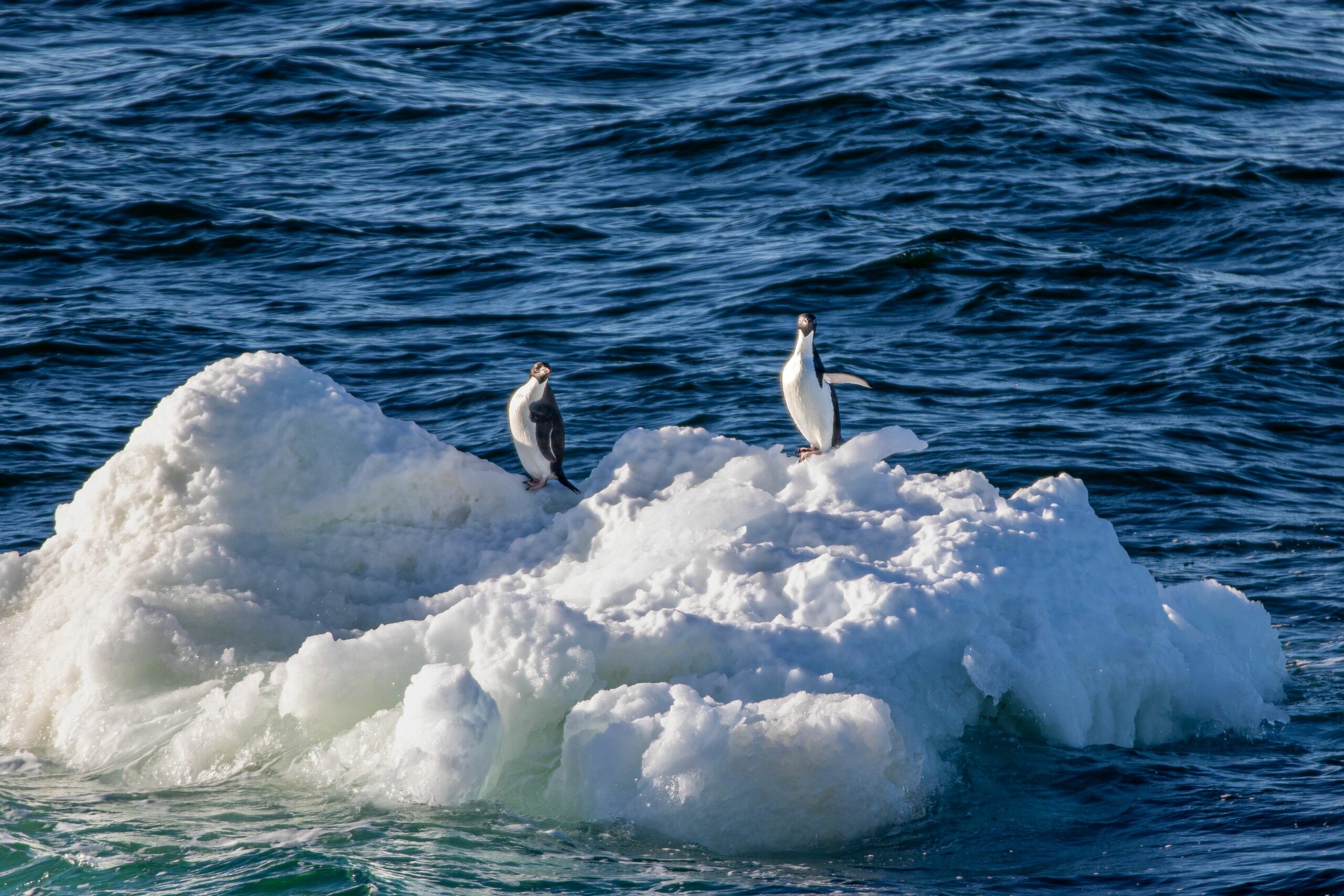
Adelie penguins on small iceberg (photo: Knut Heinatz) 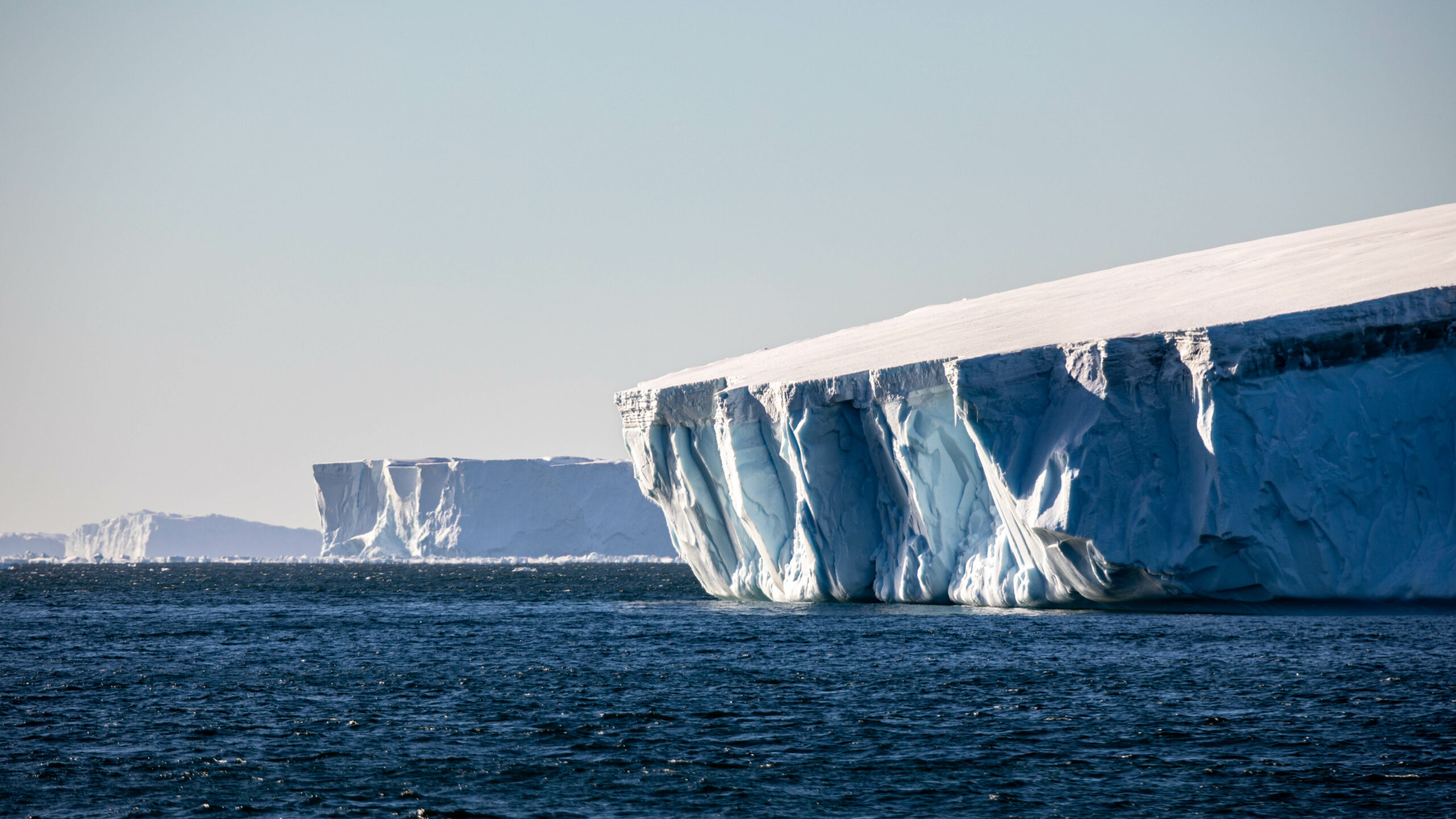
Layers in ice (photo: Knut Heinatz) 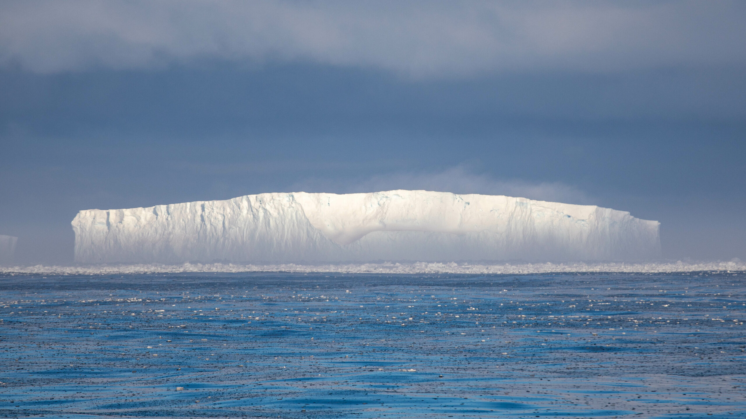
photo: Knut Heinatz 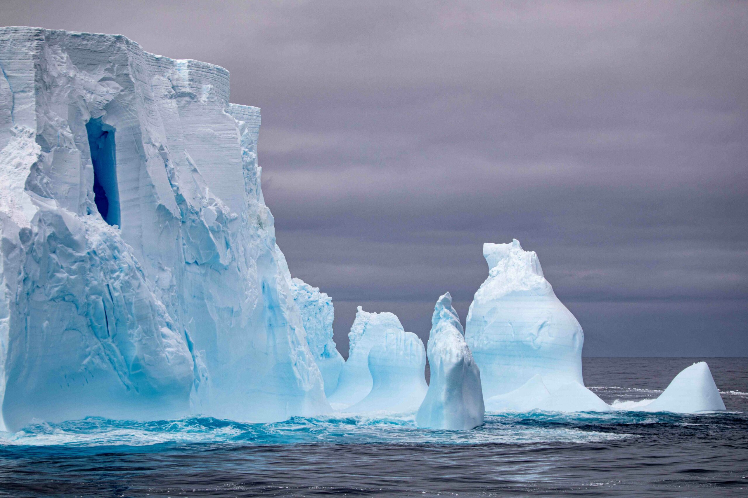
photo: Knut Heinatz 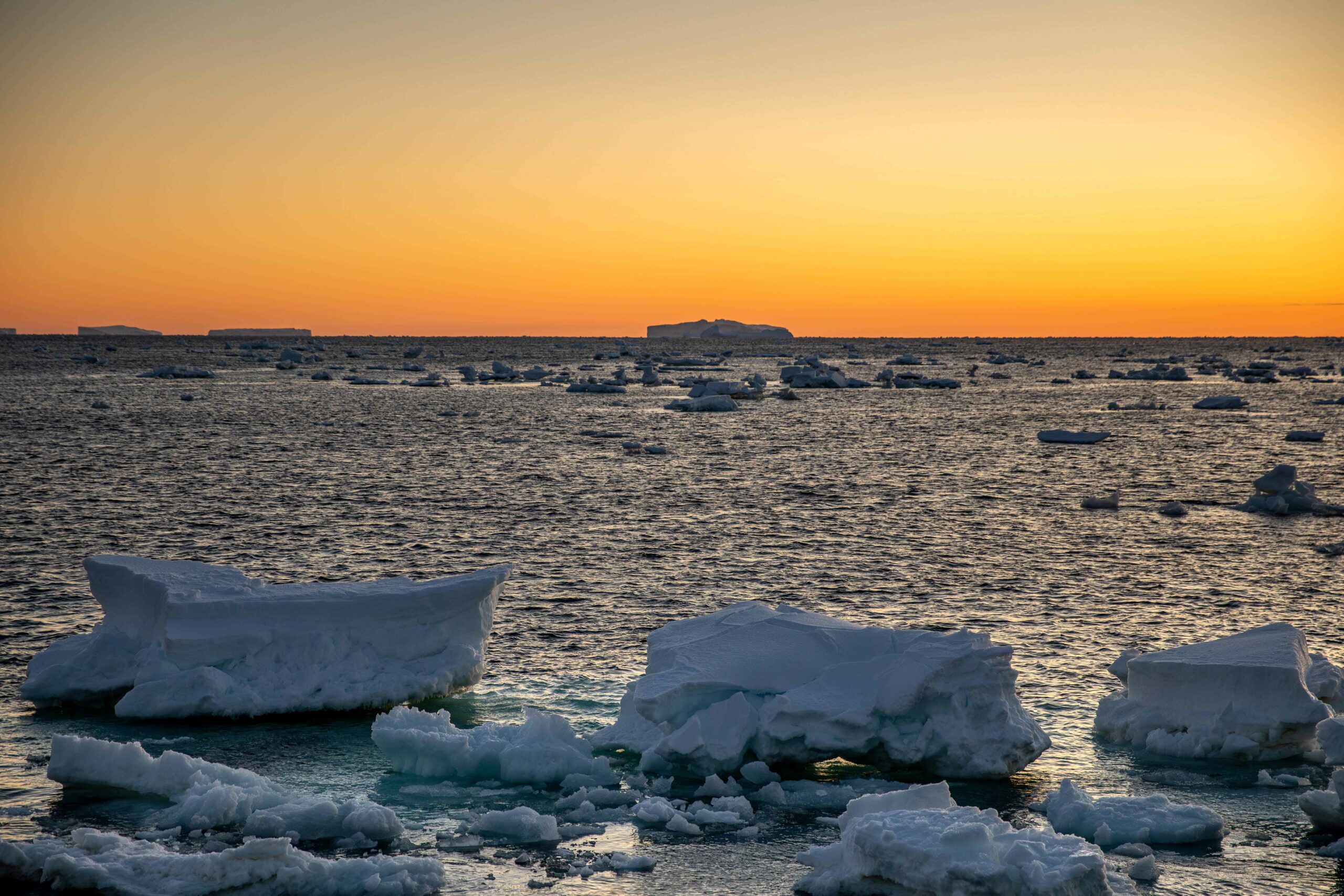
photo: Knut Heinatz 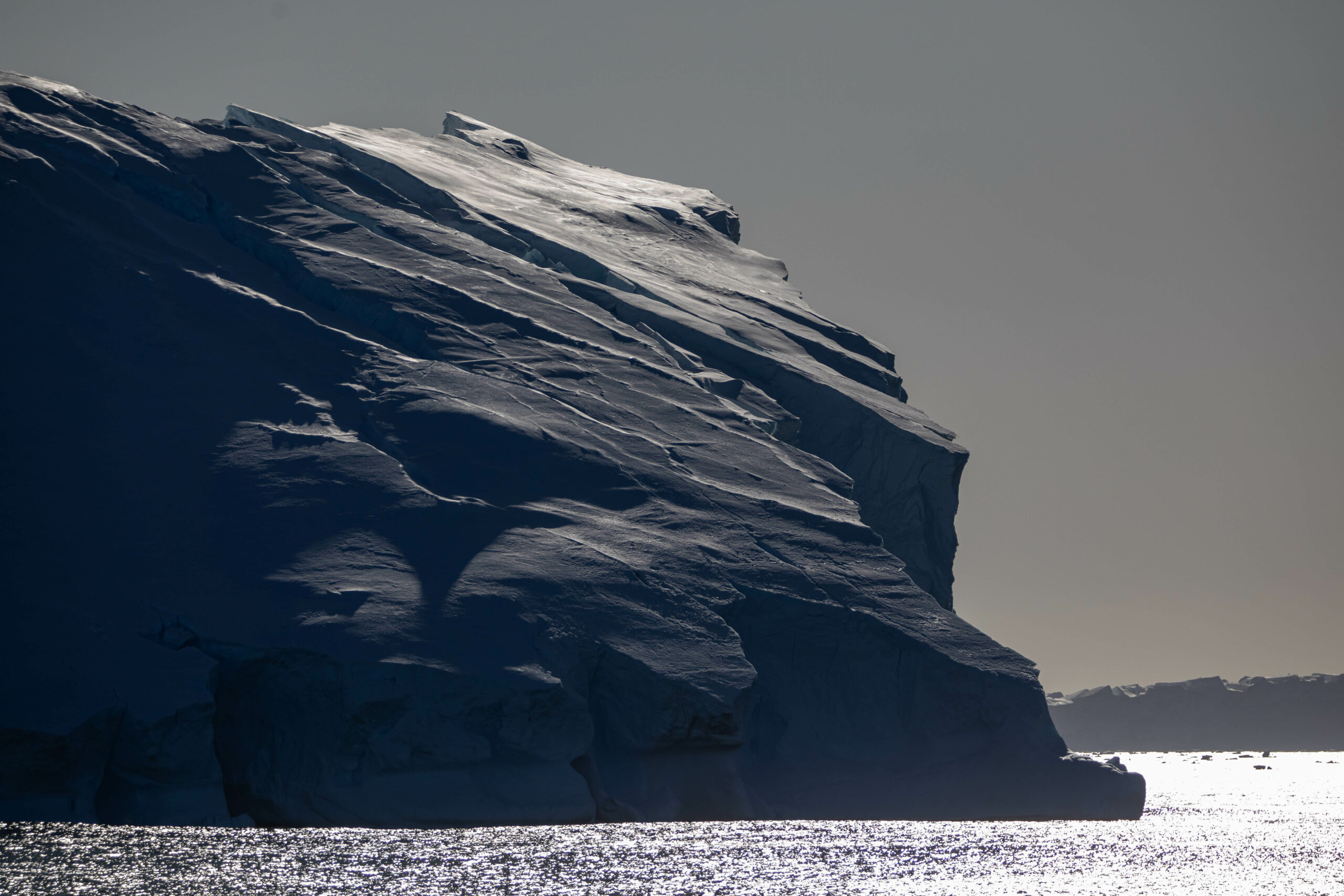
photo: Knut Heinatz
This research is supported by a grant of sea time on RV Investigator from the CSIRO Marine National Facility which is supported by the Australian Government’s National Collaborative Research Infrastructure Strategy (NCRIS).