Temperature, salinity…and the need for speed
Dr Helen Phillips, co-chief scientist FOCUS voyage, Australian Antarctic Program Partnership
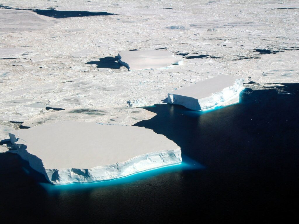
This FOCUS voyage is our second visit to the Macquarie ‘meander’, our favourite leaky place in the heat transport barrier formed by the Antarctic Circumpolar Current (ACC). A meander sounds gentle and slow, but in fact it’s where the world’s strongest current races through a series of hairpin bends, steered by mountains on the seafloor.
We came here in 2018 and have been working hard on the dataset we collected five years ago. You might wonder why we need more than one big voyage to answer all of our questions about the Southern Ocean. Why keep coming back?
The reality is that every voyage builds on our level of understanding and paves the way for further discovery. The scientists aboard this FOCUS voyage on CSIRO research vessel (RV) Investigator bring experience from their particular area. The combination of different skills and knowledge is what we need to answer pressing questions for society – like how much heat is crossing the ACC to threaten ice in Antarctica and how this might change in the future.
For example, Benoit Legresy from CSIRO has worked with satellite-borne radar altimetry for many years and played a role in the development of the science program for the SWOT satellite. SWOT is the new kid on the block with laser-sharp vision of the small-scale features that are so important for moving heat in the ocean. Kurt Polzin from the Woods Hole Oceanographic Institution has been developing the mathematics and instrumentation to explore internal ocean physics of deep currents and turbulence for decades. My own interest is ocean velocity – the speed and direction of the ocean currents that carry heat, salt, carbon and more around the world and from the surface to the bottom of the ocean.
Ocean velocity is much harder to measure than, say, temperature. In the very early days, an oceanographer could grab a bucketful of water from the ocean surface and stick a thermometer in to measure the temperature. Fast forward to now, we have the Argo program that gives us monthly 3D maps of ocean temperature and salinity down to 2000 m globally. We’re not yet at that stage with velocity but we’re inching closer.
The early days of ocean velocity measurements were from ships navigating the ocean. They estimated where they should be based on their speed and the course they set and then the difference between that and where they actually ended up was due to currents pushing them along.
Most velocity measurements these days are from research vessels or from instruments attached to a mooring, covering not many locations in a very vast ocean. To be able to measure currents globally we need ocean robots – like Argo floats but with velocity sensors.
Since 2008, we’ve been using EM-APEX (ElectroMagnetic – Autonomous Profiling EXplorers) profiling floats that are Argo floats at heart with an electromagnetic system added on to measure velocity. We’ve learnt so much about the ACC from EM-APEX and have been helping demonstrate their extraordinary value to the world. We could never have enough EM-APEX to give us all the detail in the ocean currents everywhere. However, the relatively small number of EM-APEX and other velocity measurements reveal processes that are causing change in the ocean. Combining what we know about ocean physics and measurements from large-scale observing programs like Argo and satellites, we can extend insight from EM-APEX to other parts of the ocean. More about that later.
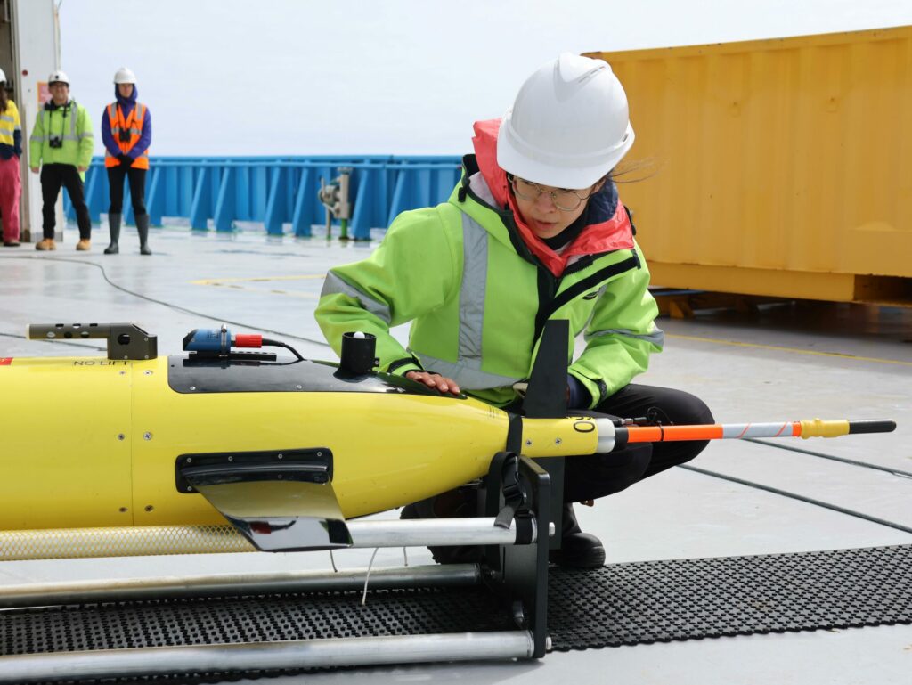
We’ve been fortunate to have two EM-APEX profiling floats from University of Washington in our oceanographic toolkit for the FOCUS voyage. But what actually are they? The base Argo float measures temperature, salinity and pressure using a CTD. The added electromagnetic velocity sensors measure current speed and direction. Like Argo floats, position is tracked by GPS and communication to shore is via the Iridium phone network.
What you see on the outside are five electrodes around the top cap, and fins on the body to make it rotate as it sinks and rises through the ocean. Inside is a magnetic compass and tilt sensor. The electrodes measure the electric current that is created by the salty ocean currents moving through the Earth’s magnetic field. These voltages are converted to ocean current speed and direction and then transmitted to the receiving station on shore, along with the CTD and other data.
So, what comes next? This FOCUS voyage is part of a four-year international program “Antarctica’s leaky defence to poleward ocean heat transport”, which is a collaboration with US and Korean research teams, including the University of Washington group who provided the EM-APEX for FOCUS. We have more EM-APEX deployments planned for the Southern Ocean between Tasmania and Antarctica and work with high-resolution ocean models.
We know that the strong winds over the Southern Ocean have been increasing for decades and are likely to continue to do so. We expect that this will lead to increasing southward heat transport through leaky meanders, accelerating melting in Antarctica and sea level rise. The goal of our work is to turn daily maps of ocean sea surface height from satellites into daily maps of the movement of heat in the Southern Ocean toward Antarctica.
We need this information to help governments plan how to respond to ocean warming and rising sea levels and how quickly they need to act. Then, as our transition to a net-zero world gathers momentum, we need to be able to track the response of the ocean and our whole climate system to reductions in carbon dioxide in the atmosphere.
There’s nothing so motivating as seeing the distance close between you and your competitors to make you run harder. Ocean observations will show us when we are starting to win the race back to a safe climate.
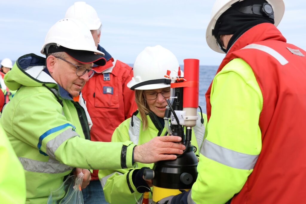
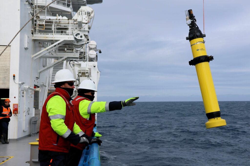
FOCUS voyage chief scientists Dr Benoit Legresy and Dr Helen Phillips prepare an EM-APEX for release (photo: Amelia Pearson) 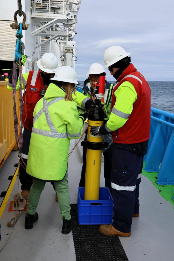
An EM-APEX float is attached to the winch on RV Investigator (photo: Amelia Pearson) 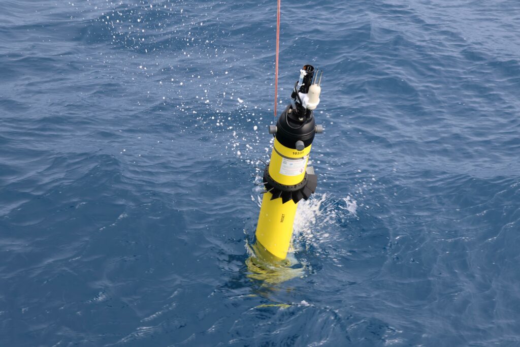
EM-APEX float begins its long journey through the Antarctic Circumpolar Current (photo: Amelia Pearson)
This research is supported by a grant of sea time on RV Investigator from the CSIRO Marine National Facility which is supported by the Australian Government’s National Collaborative Research Infrastructure Strategy (NCRIS).