Voyage to Southern Ocean ‘hotspot’ probes how planet’s strongest current helps melt Antarctic ice
13 November 2023
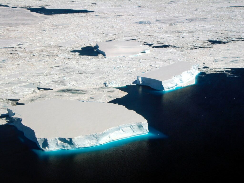
CSIRO’s research vessel (RV) Investigator is heading into the heart of the Antarctic Circumpolar Current (ACC) to investigate why the planet’s strongest current that helps keep the Antarctic frozen is leaking heat into the polar seas.
The science team led by Australia’s national science agency, CSIRO, and the Australian Antarctic Program Partnership is seeking to understand how currents in the Southern Ocean contribute to melting Antarctic ice shelves.
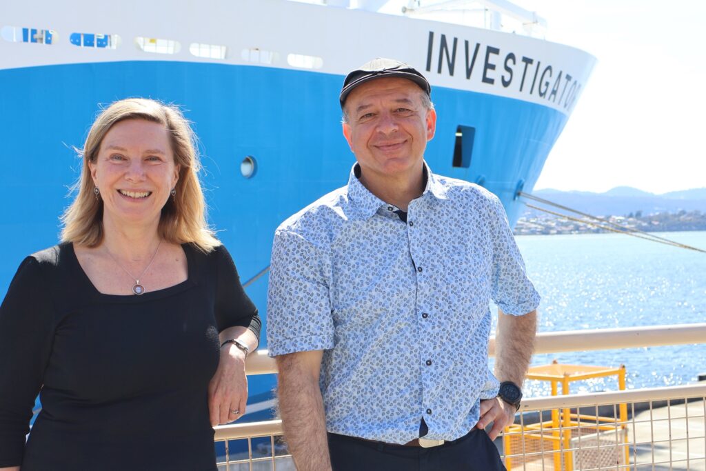
Voyage chief scientist Dr Benoit Legresy of CSIRO said the Antarctic Circumpolar Current plays an important role in understanding the impact ice melt has on sea level rise.
“The Antarctic Circumpolar Current flows around the icy continent from west to east and acts as our safety belt so that the warm water doesn’t reach the Antarctic and melt the ice,” Dr Legresy said.
“But the Antarctic Circumpolar Current generates the whirling eddies and finer scale dynamics that we’re trying to understand, and which are the prime suspect for warm water seeping towards the pole.”
“There are five ‘eddy heat flux gates’, or hot spots, identified around the Antarctic Circle and they’re acting as a gateway for the heat to go south. We’re going to track down those small features that we think explain the heat seeping into polar waters.”
The voyage will be the first time scientists can validate data from the new Surface Water and Ocean Topography (SWOT) satellite, jointly developed by NASA and the French space agency Centre National d’Études Spatiales (CNES).
While the ship measures the properties of the ocean inside the current, the satellite will measure the height of the ocean surface from space. The SWOT satellite is revolutionising how scientists observe Earth’s water elevation with 2 km pixel, high-definition topography.
Passing over the Southern Ocean, SWOT will take the highest resolution ocean topography to date of the Southern Ocean and eddies within the Antarctic Circumpolar Current. These smaller-scale ocean features contribute to redistributing heat and carbon and energy in the ocean, major components in global climate change.
Voyage co-chief scientist Assoc Prof Helen Phillips, from the Australian Antarctic Program Partnership at the University of Tasmania, likened the SWOT technology to a short-sighted person seeing a tree in the distance, and putting glasses on to see all the leaves.
“That’s the transition from our traditional satellite altimeters: we know these really large eddies are very important for moving heat around in the ocean, but with the SWOT satellite we can see the very fine-scale features that are breaking away from these eddies that we think are actually doing most of the work.”
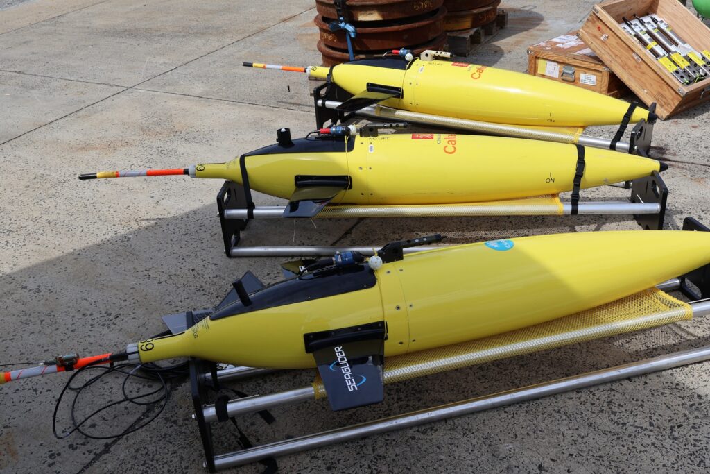
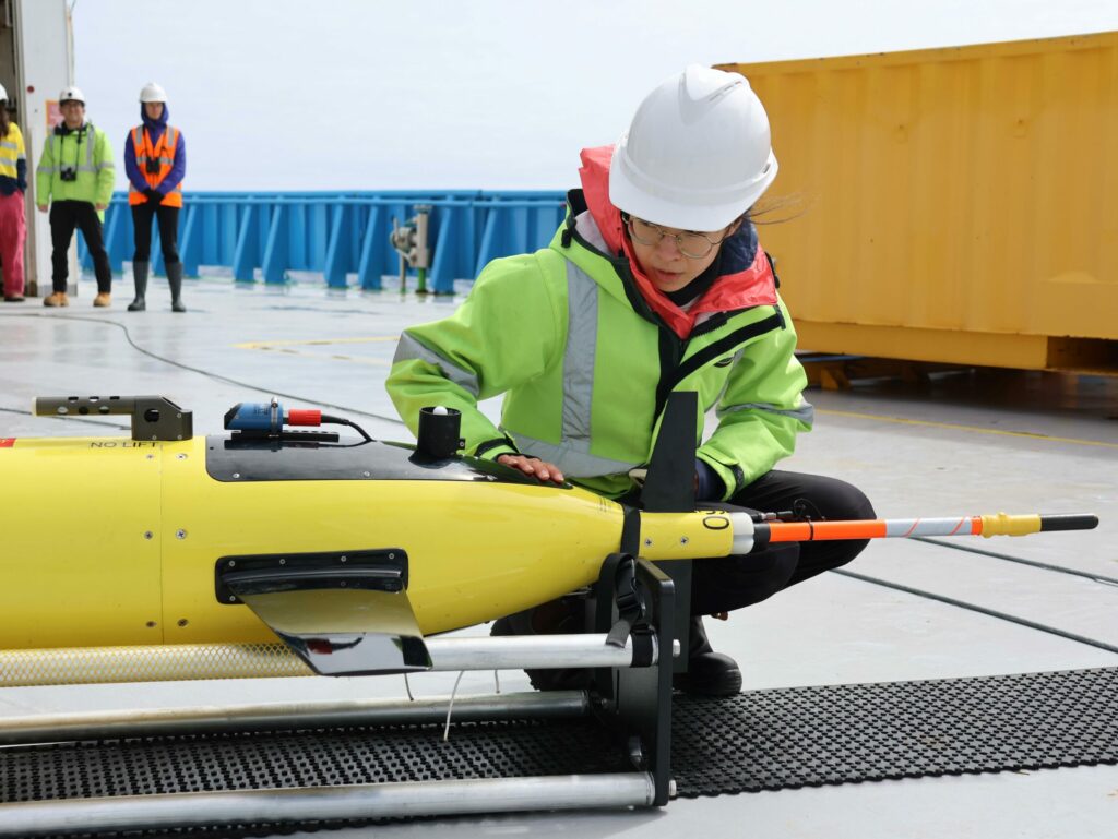
“While the SWOT satellite is such an incredible revolution, we have other advances in the instruments we put in the water, like ocean gliders that are piloted from the ship or on shore to look beneath what the satellite is seeing at the surface and show us the structure of these fine scale features inside the ocean.”
“The satellite gives us the surface patterns, where we see the changing height of the sea surface and the gradients across that driving the horizontal currents. But underneath that surface is all this vertical movement taking heat and carbon out of the atmosphere and putting it into the ocean.”
“Being able to pair that surface view from the SWOT satellite with what we can measure with our instruments gives us a valuable three-dimensional picture of what’s driving these processes.”
“Taking our voyage to this hotspot will tell us a lot about what’s controlling heat movement across the Southern Ocean towards Antarctica and how that might change in the future,” Dr Phillips said.
The voyage continues a tradition of highly collaborative, international science concentrated on the Antarctic and the preservation of the icy continent.
Principal investigators relying on data collected from the voyage as part of their ongoing research include scientists from CSIRO, the University of Tasmania, Caltech (the California Institute of Technology), Woods Hole Oceanographic Institution, the University of Washington and the Laboratoire d’Etudes en Géophysique et Océanographie Spatiales.
The voyage departs Hobart in mid-November and returns 20 December. Follow the voyage here.
This research is supported by a grant of sea time on RV Investigator from the CSIRO Marine National Facility which is supported by the Australian Government’s National Collaborative Research Infrastructure Strategy (NCRIS).